Around Edlingham
We went out today to look at a handful of neat historical things in the hills and woods around Edlingham, in Northumberland.
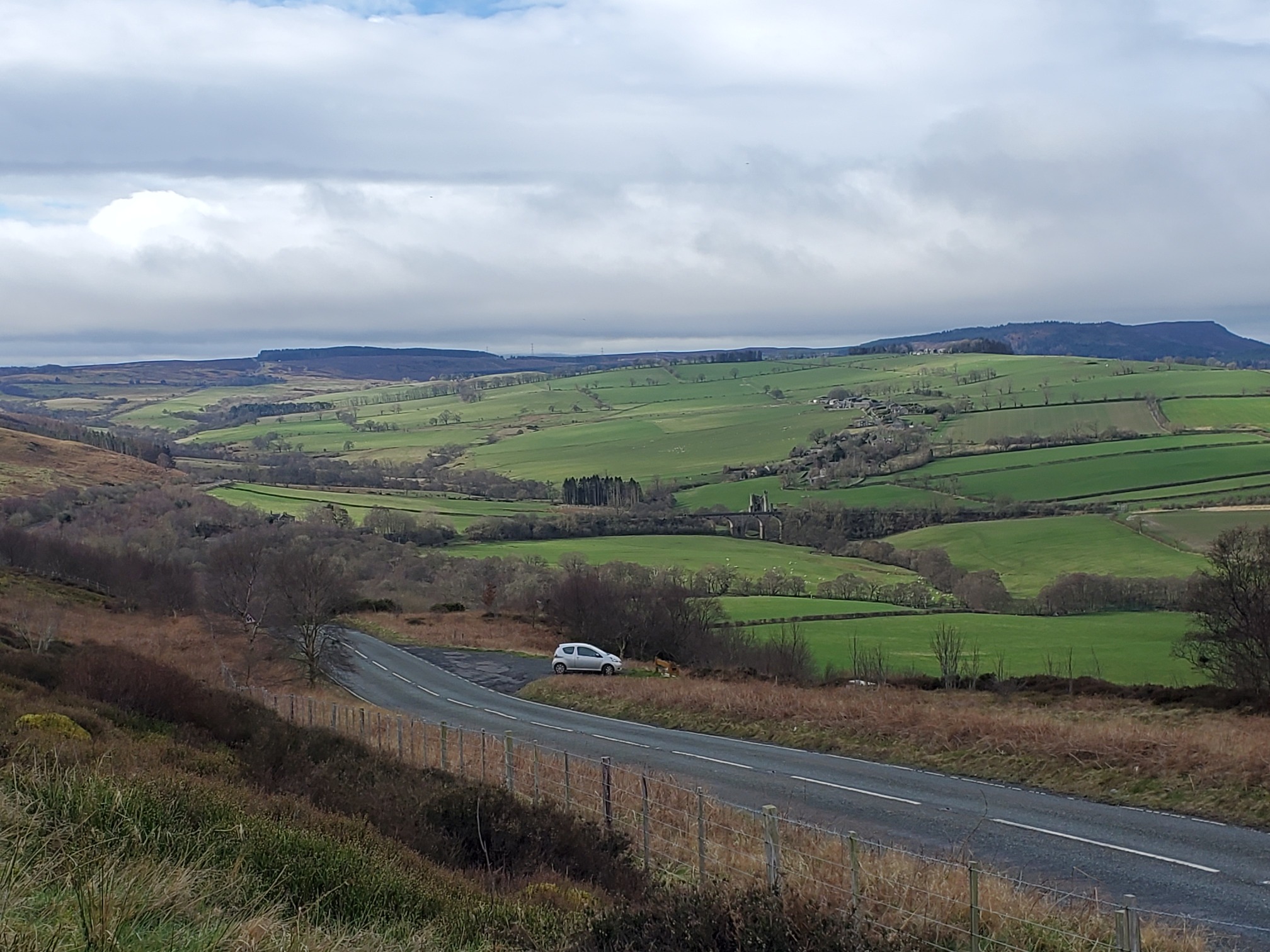
Turning off the A697 at what was once the Swinburne Arms on the old turnpike, the B6341 cuts above the village of Edlingham on its way to Alnwick. It passes on top of Corby’s Crags (Corby being Northumbrian/Scots for Crow) where there’s a handy car park to take in the view across to the Cheviots.
 |
|---|
| A view down to the road, and beyond it gently undulating green farmland leadng off to cloudy dark hills of the Cheviots on the horizon |
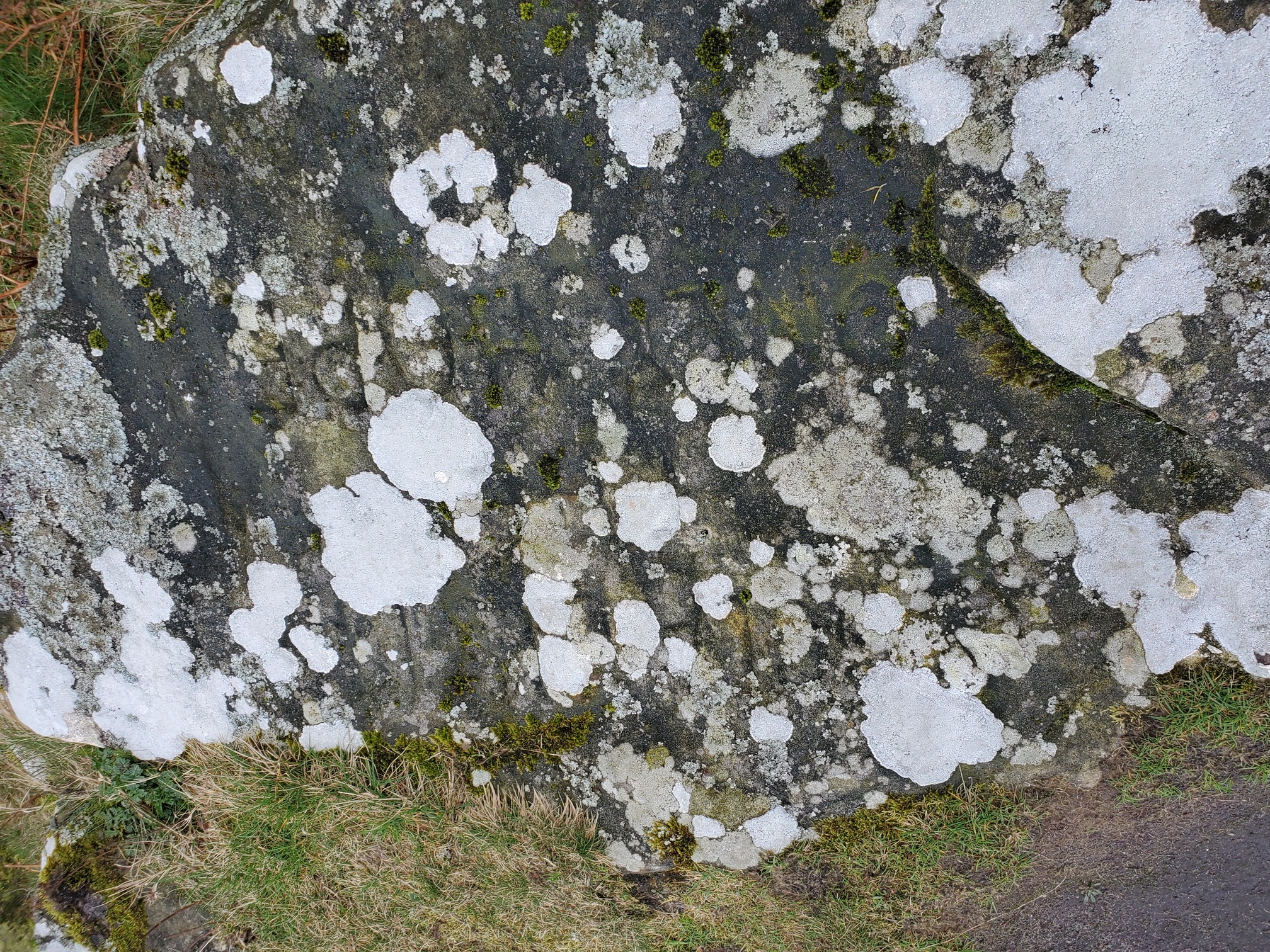
There, beneath the car park, the following were carved into the rock during the 1930s:
SOCIALISM THE ONLY HOPE
At some point, HOPE was changed to DOPE, and then changed back again to HOPE.
 |
|---|
| A sandstone rock covered with lichen; only a few block capitals can be made out, including “hope” |
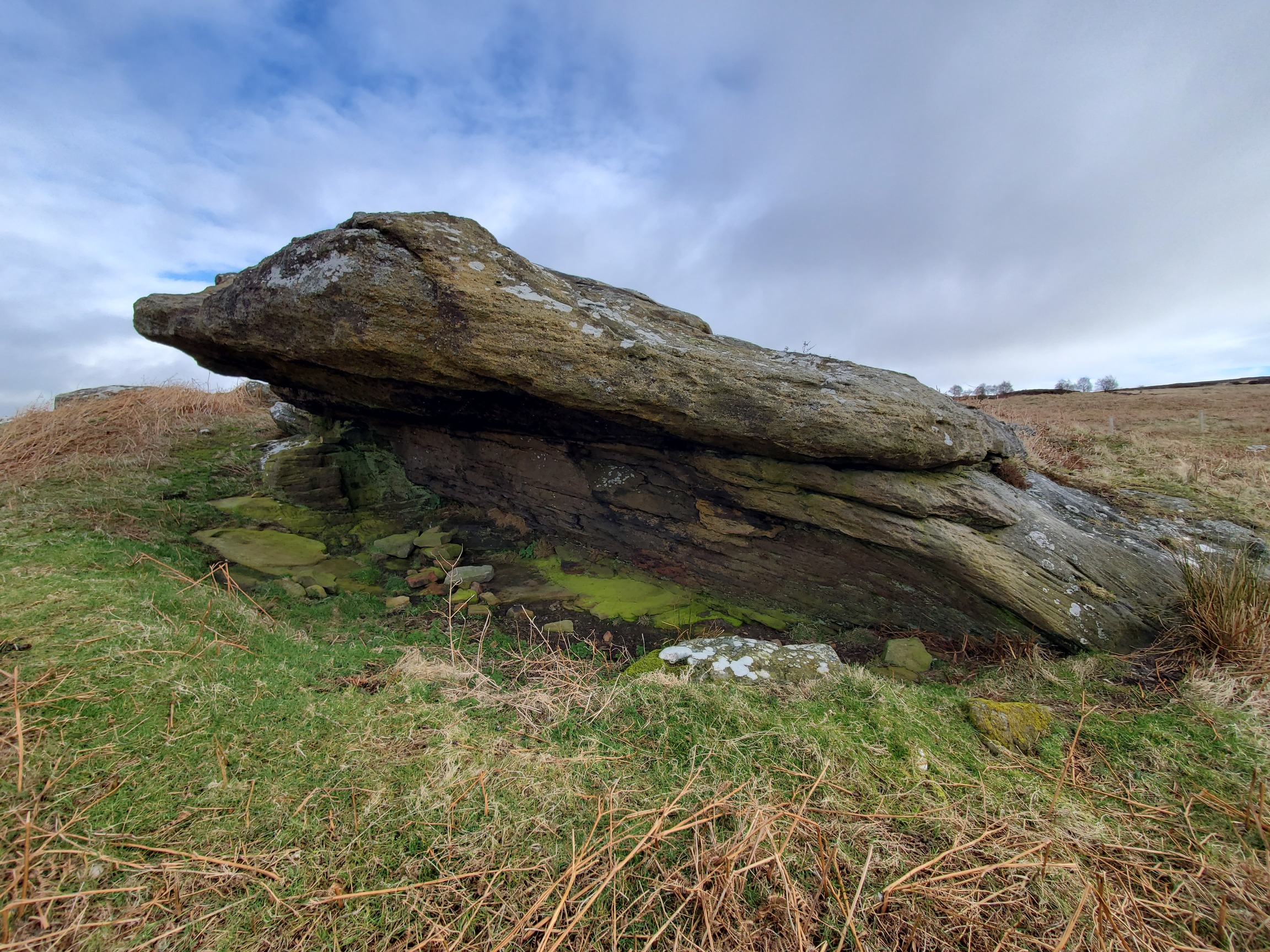
From here, crossing the road and a short walk uphill leads to Corby Rock Shelter, a hollow under a rocky outcrop.
 |
|---|
| A rocky overhang protrudes from grass and bracken |
Stan Beckensall excavated here in the 1970s (full report here) finding pieces of worked flint from a mesolithic flaking-floor, bronze age cremation burial, and more modern artefacts like pipes and cups that suggest it was used as a shelter, possibly for shepherds or the miners working in small bell-pits in the area.
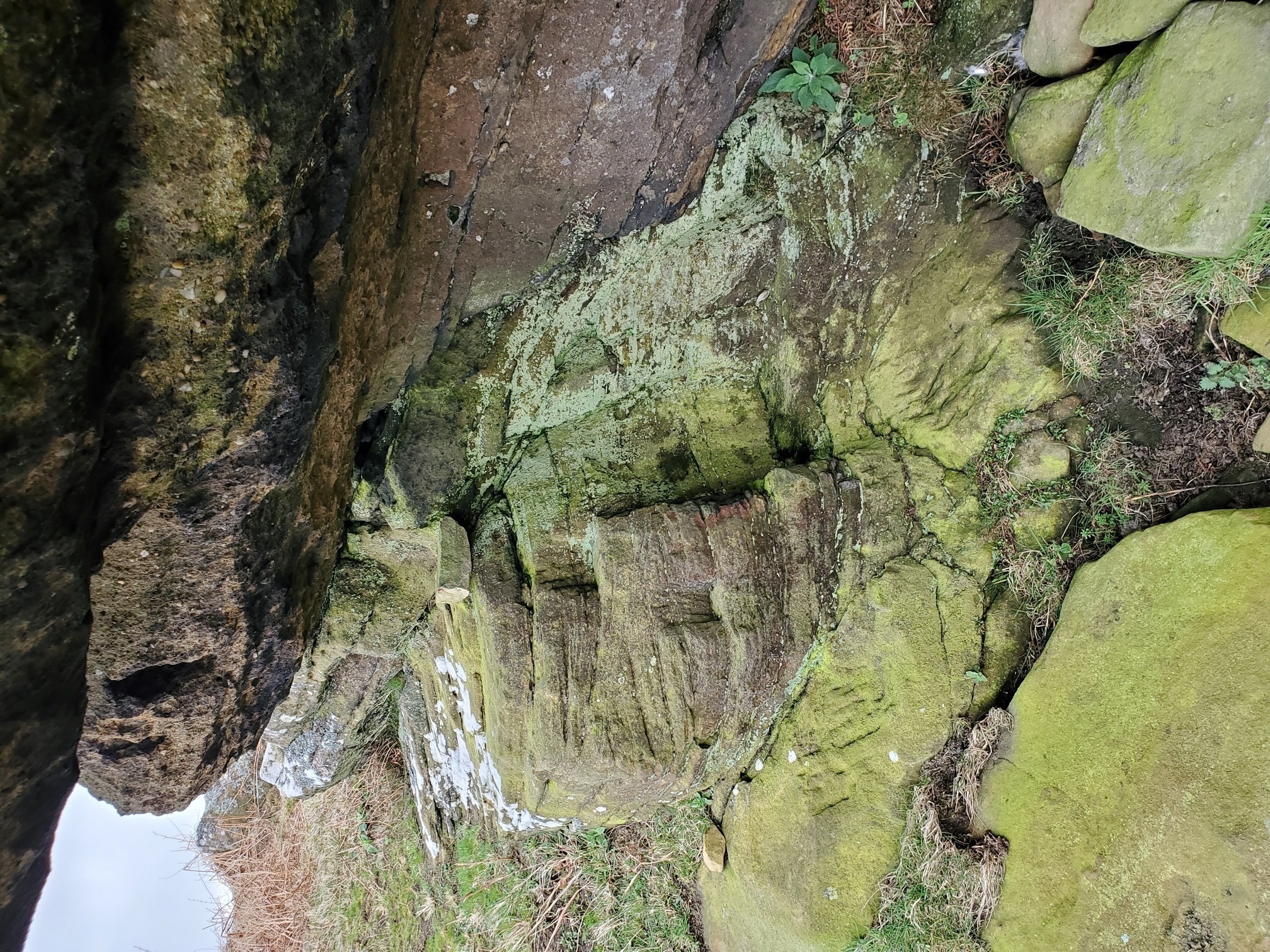
Inside the shelter, under the overhang, you can clearly see the tool marks where someone has hacked out a seat and a couple of small niches, for lamps or pots.
 |
|---|
| A shepherd’s seat, carved into the side of the shelter |
Downhill again, and we meet Corby’s Letch (letch being a watercourse that drains moorland).
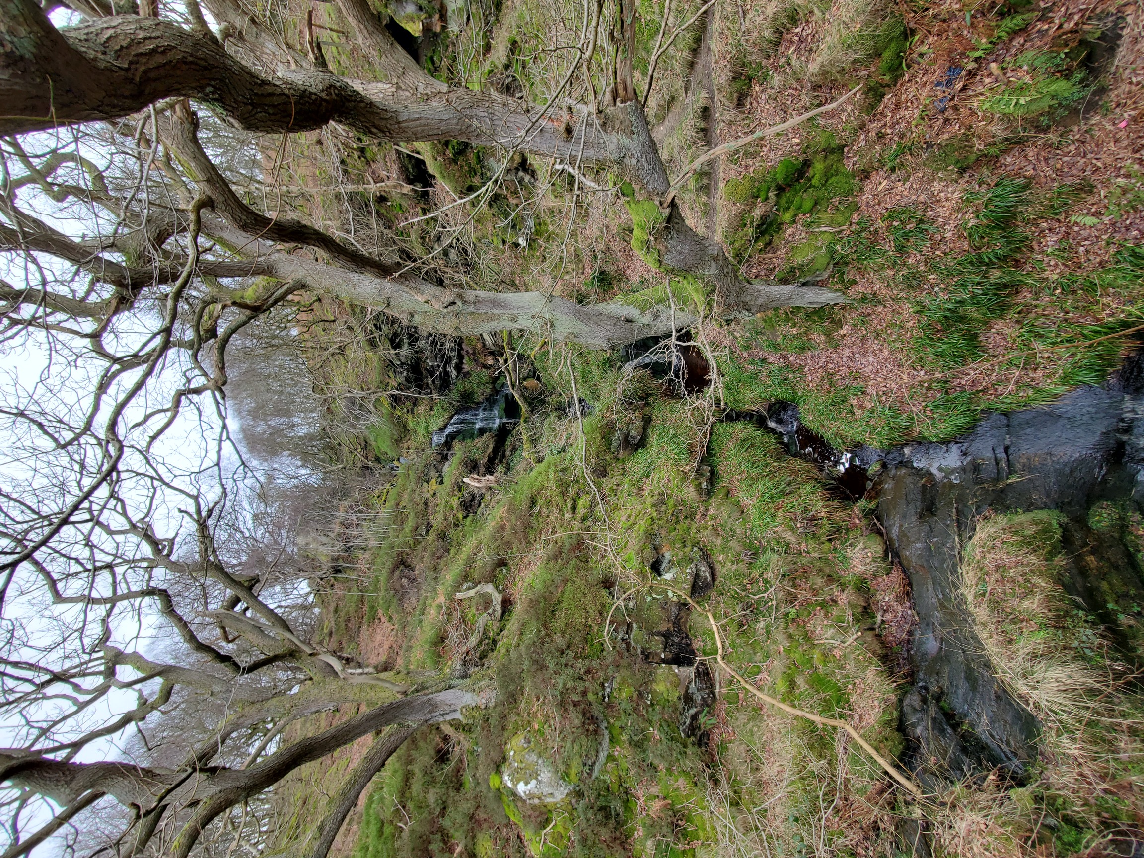 |
|---|
| A waterfall cascades down a grassy slope, framed by bare trees |
This pretty waterfall is right by the road bridge, of which I was more interested as you can see where a bigger bridge has been built on a smaller, older one, and then again where that has been widened to form the modern bridge.
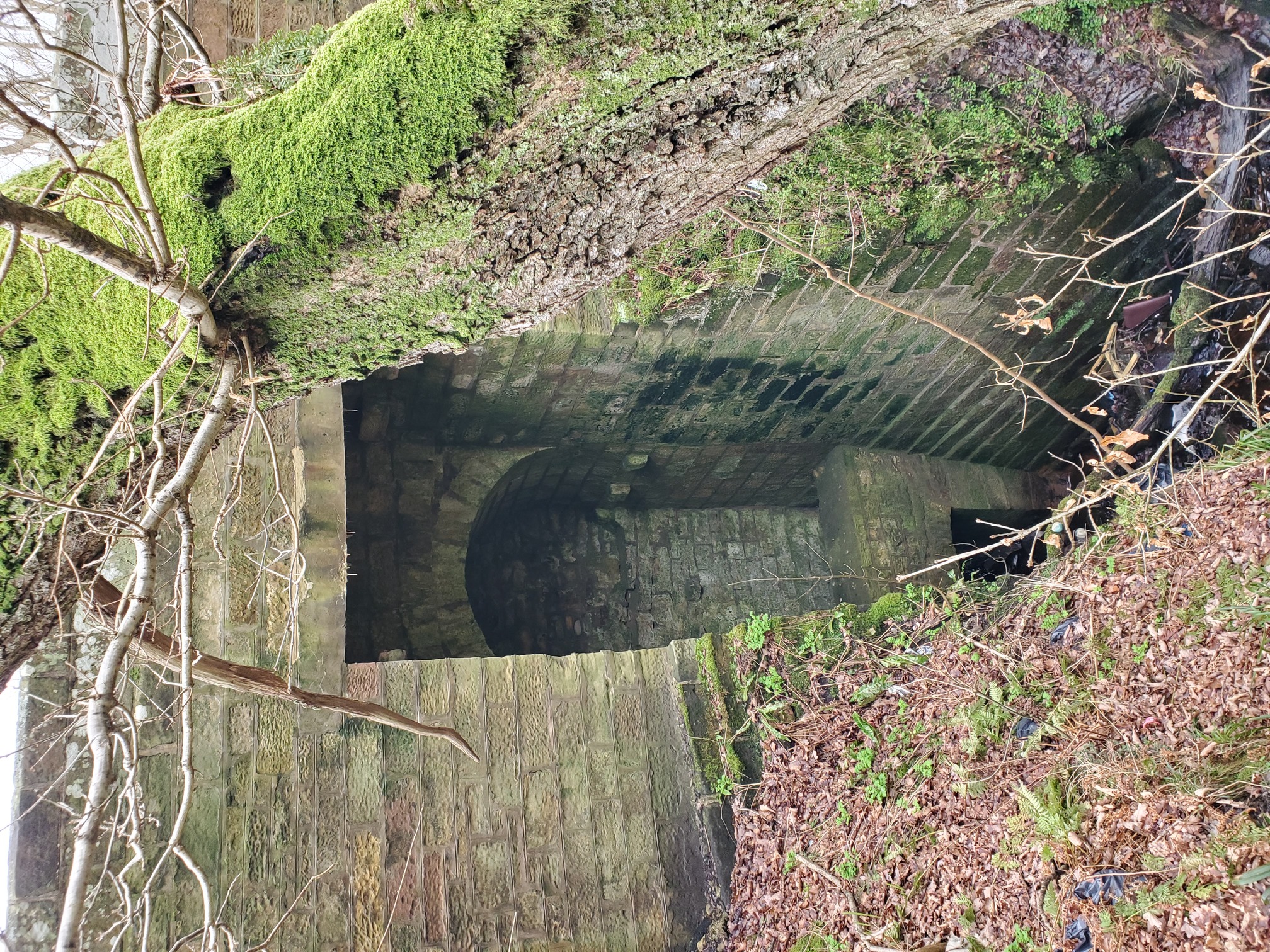 |
|---|
| A tall road bridge crosses the stream, a square arch outermost, behind this a tall curved arch. Beneath it, a smaller, square bridge. The whole thing is bricks upon bricks. |
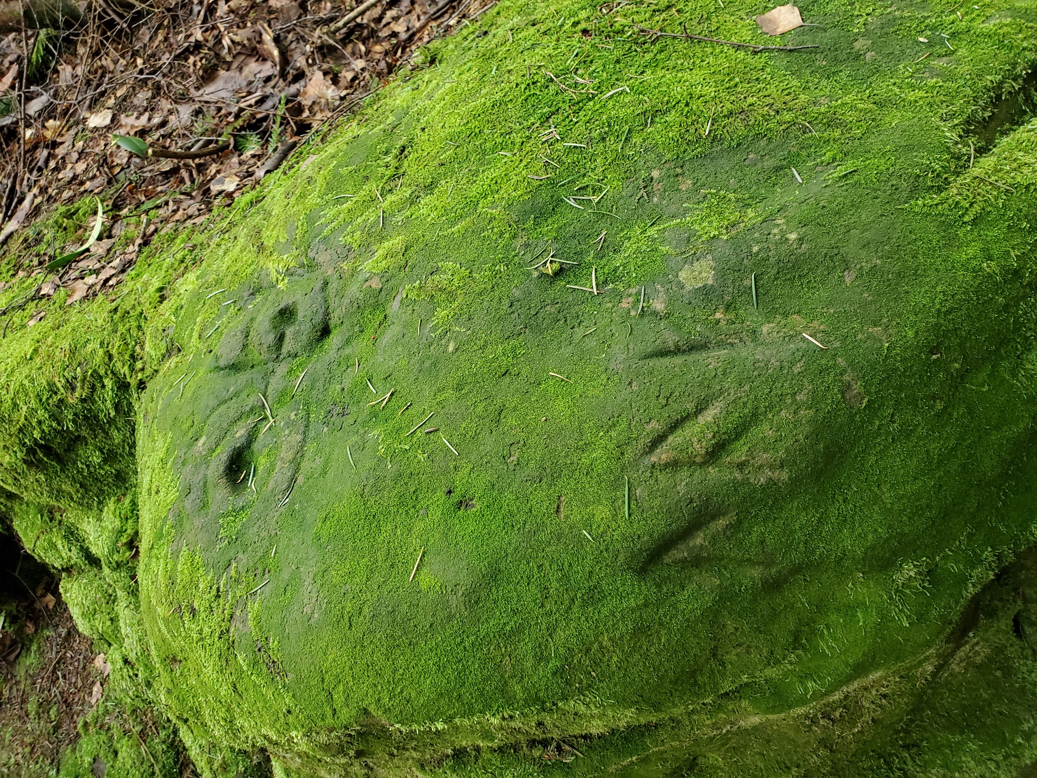
A few minutes drive up the road takes us to Lemmington Woods, a small plantation forest. Here is a set of cup-and-ring marked rocks, circular and concentric ring motifs from the neolithic, found carved into rocks across Western Europe and dated to around 4,000 years ago. In Lemmington Woods, they are accompanied by a runic inscription:
 |
|---|
| A rock green with lichen and moss. To the left, carved into the rock are two circular pits connected with concentric rings and lines. To the right, are three angual runes. |
Runic inscriptions in England are very rare, which makes this even more interesting. Thought to be from around the 10th century, according to the English Heritage Listing:
Experts in Runic inscriptions have interpreted the text as either ‘to leave or leave behind’, from the Old English verb laefen, or ‘a remnant or relic,’ from laf. An alternative is that they are Old Norse, from the noun lof, meaning ‘praise or permission,’ or laf, meaning ‘bread or sustenance.’
Apparently Ronald W.B Morris in his book The Prehistoric Rock Art of Galloway & the Isle of Man lists 104 possible theories about what these cup-and-ring marked rocks were actually for. The knowledge is lost to us now, but did the Anglo-Saxon or Viking who carved these runes a thousand years ago recognise them and understand them?
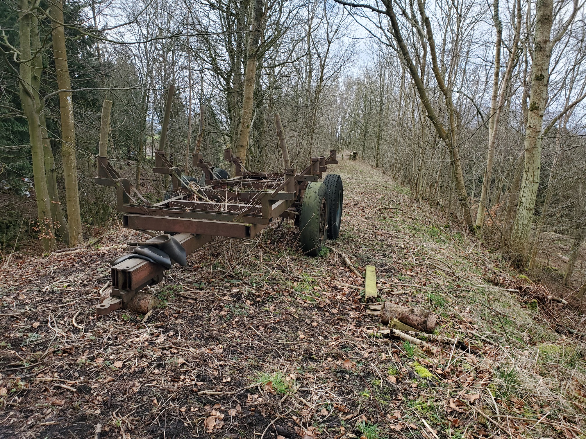
Further into the woods, along a disused track bed of the Alnwick & Cornhill Rail Line, is a relic of slightly more modern history.
 |
|---|
| The forester’s ramshackle wagon with large rubber tyres sits on the track bed, with bare trees either side. The line was opened in the 1870s, closed to passengers in the 1930s and goods by the 1960s. |
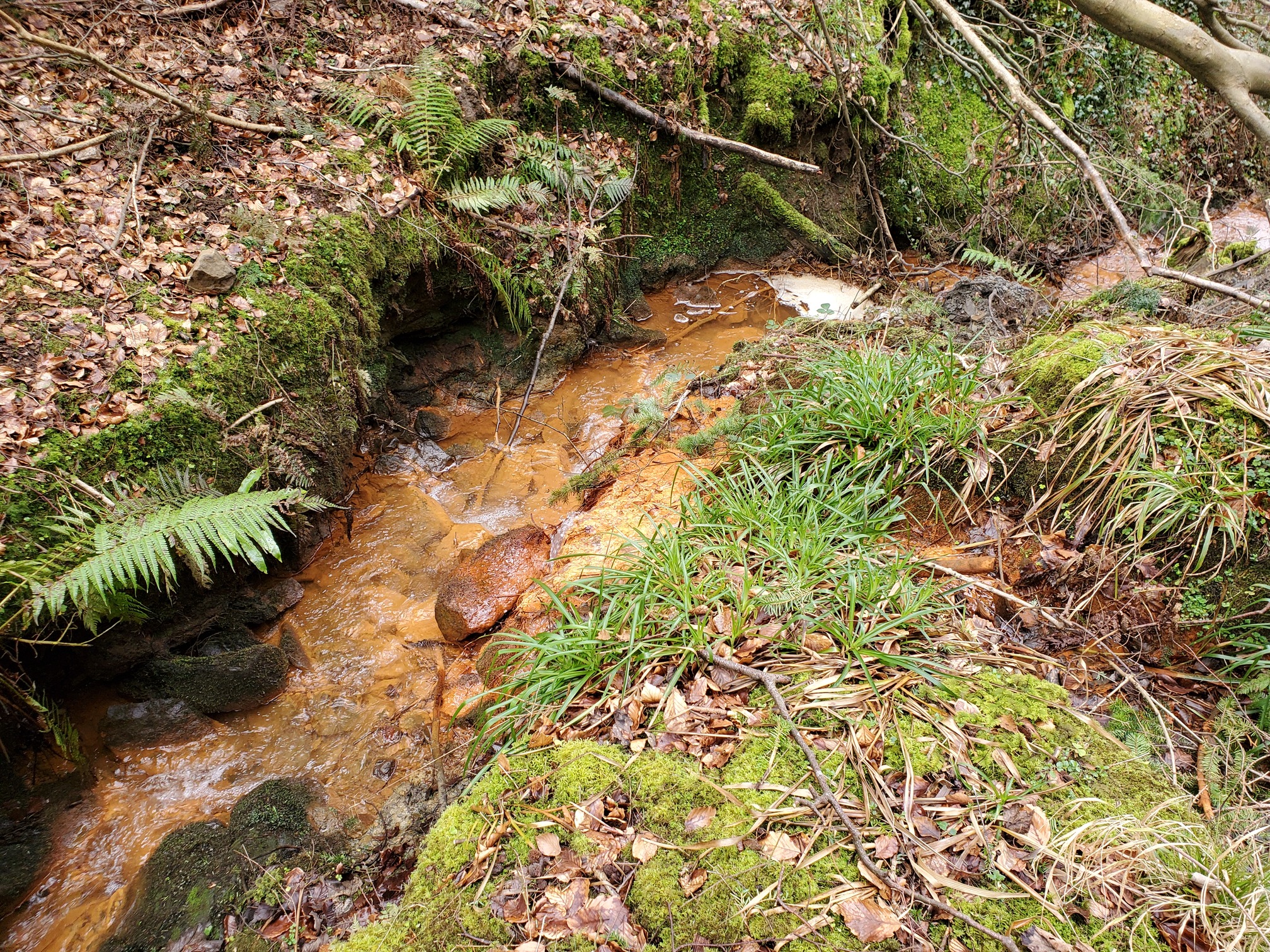
Uphill from these woods, water flows through simple 18th century bell-pits where coal was mined. Passing along the coal seam, it washes out the iron and re-emerges at springs feeding this burn and turning the ground a vivid orange - the water itself seems quite clear however. The Victorians called this a Chalybeate spring - spring waters containing salts of iron.
 |
|---|
| An orange burn flows quickly between mossy banks. The ground ether side is covered with leaves and ferns overhang the burn. |
| Location map of things we saw today |
As usual, Northumberland is absolutely covered with history. Where next?