The Border Stones
I always assumed the border between England and Scotland was fixed when King James IV became the I of England. I was looking at a post on the Heddon-on-the-Wall’s history society, about the Named Stones of Northumberland, a list published in the Berwickshire Naturalist’s Club in 1879, p531-536, link here. As well as an interesting article, the author had also converted the locations in the 1879 publication to a handy KML file, so I put it into QGIS to see if there was anything near any walks I was planning.
A small cluster of stones above College Valley caught my attention: The Two Gray Stones, Tuppie’s Grave nearby, a bit further north were the Stob Stones and The Grey Stone. These were recorded as marking the former line of the Scottish-English Border, so, I thought, must be quite old.
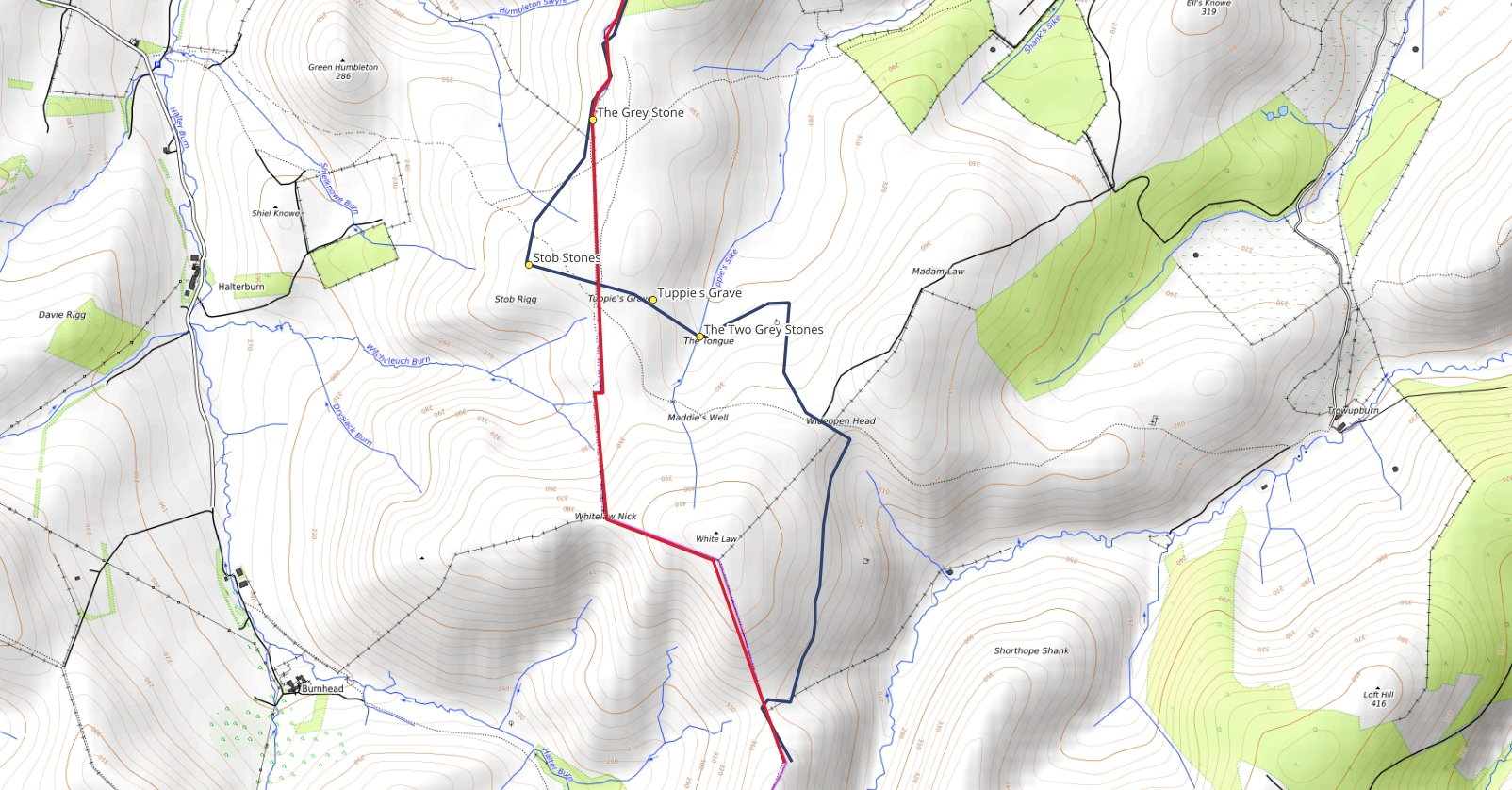
I went to the excellent NLS Maps to have a look at the first 6” maps, published in the mid 1800s, and straight away noticed that the border is completely different in this area. The modern border goes more or less north-south from the Gray stone past Tuppie’s Grave to Whitelaw Nick; the 1800s border zigzags between Grey Stone, then to the Stob Stones, then past Tuppie’s Grave to The Two Gray Stones, Wideopen Head, to join the modern border south of White Law. I’ve drawn the old border (dark blue) on this map to compare with the modern border (red), or you can compare them on NLS Maps here.
 |
 |
The Heddon-on-the-Wall history page has a lot, lot more detail on both the stones marking the border and the border itself and why and how it changed. In summary: the area was used by the residents of Kirk Yetholm for grazing and peat cutting despite technically being in England, and it was referred to as “debateable land” (which I didn’t realise there was any of this far east - there was some debateable land nearer Carlisle and I think in Redesdale) and called Yetholm Common. The border was supposedly fixed in the 1200s, but various people didn’t agree; by the late 1700s there are regular legal battles over it but by the time you get to the 1800s and the industrialisation of agriculture, common land is less important so in 1861 the various lairds came together, declared it was no longer common land and divvied it between Tankerville’s estate in Northumberland and Kirk Yetholm in Scotland. 63 acres went to Scotland and 101 to England, and the border was finally settled.
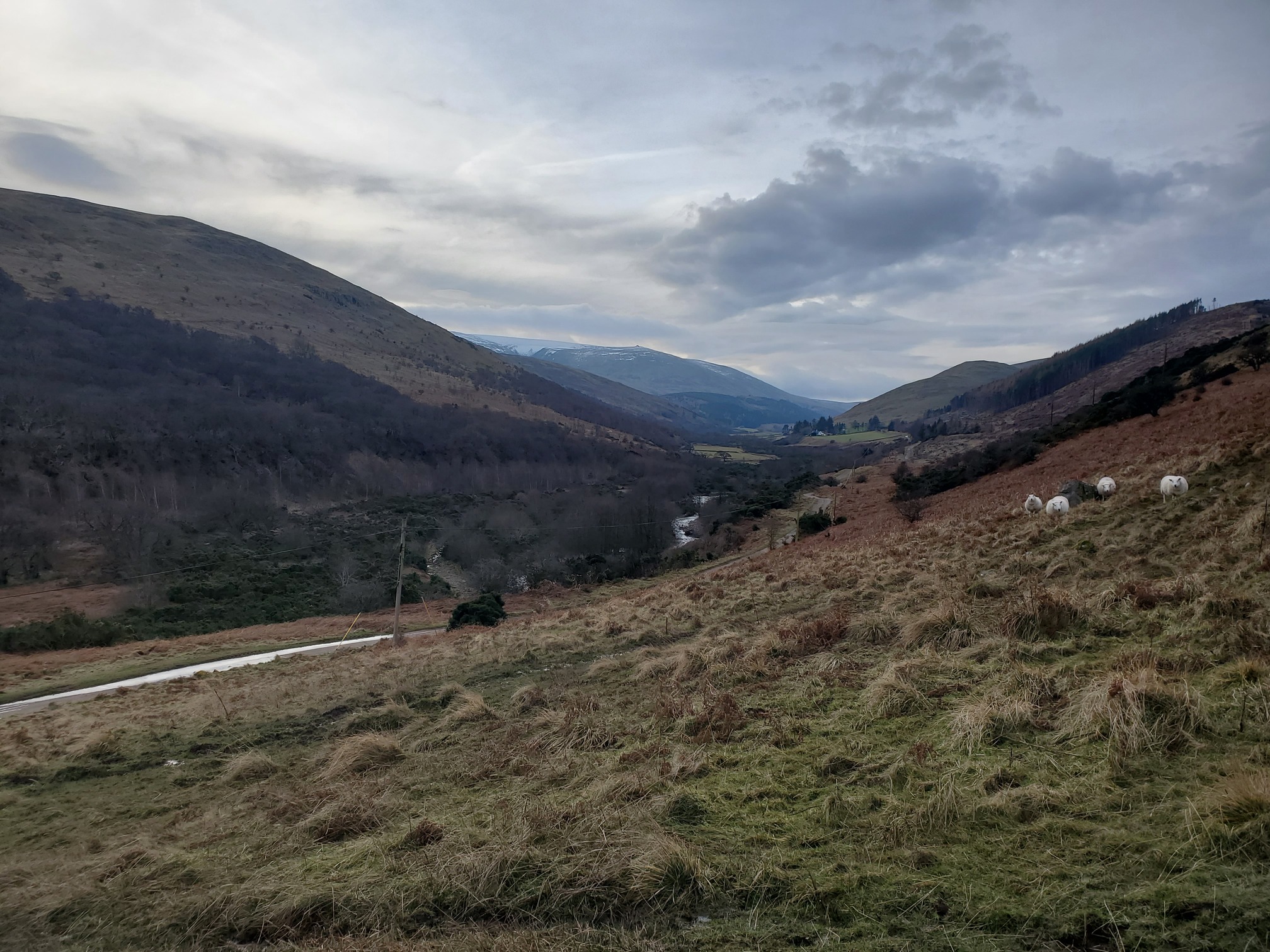
Andrew Curtis on Geograph went out to look for all these stones and the border in 2012, so I was sure that only The Stob Stones and Tuppie’s Grave are still visible. I took a walk up anyway, from the College Valley Car Park at Hethpool,
 |
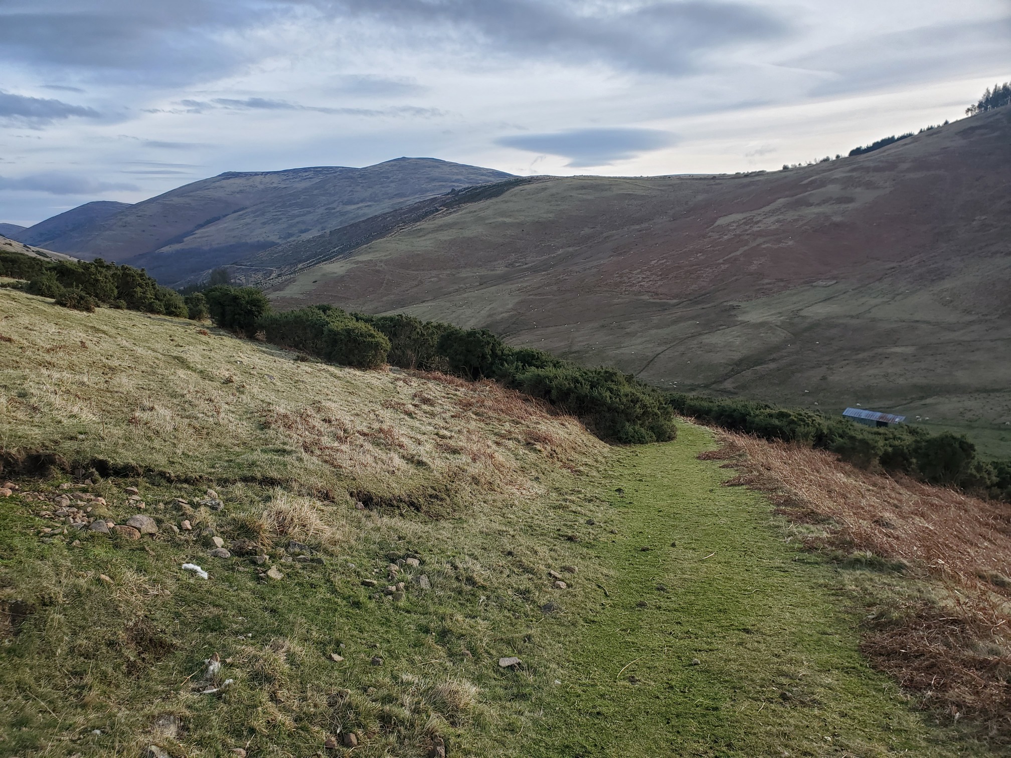
|---|
| A view up the College Valley, steep sided hills with patches of plantation forestry and dotted with sheep |
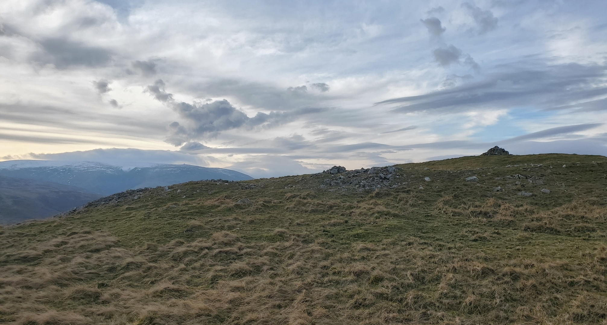
Taking in one of the many hillforts in the area at Great Hetha
 |
|---|
| A hilltop strewn with rocky ground and a cairn on top, the remains of an Iron Age hillfort. In the distance is the snow-covered flat top of The Cheviot. The sky has early morning hazy wispy clouds. |
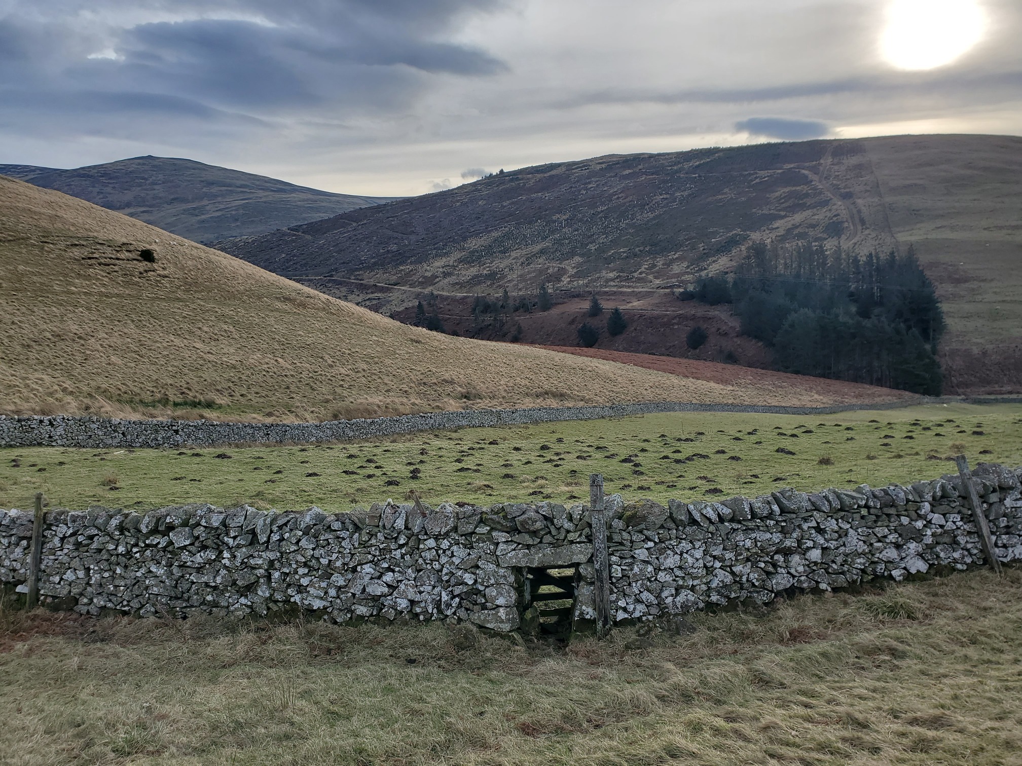
From here a wonderful walk along the shoulder of Great Hetha and down to the isolated farmhouse at Trowupburn
 |
|---|
| A drystone wall encloses a large field dotted with molehipps. Behind it, heather hills overlap into the distance. In the wall near us there is a small gate at ground level to let sheep out. |
Then the old track up from Trowupburn Farm to Wideopen Head.
 |
|---|
| Looking back down a grassy track to Trowupburn, with gorse bushes further down. I think this must be a very old track as the surface was very good under the grass. |
I love this broad valley, I think this is the Trowup Burn? It’s not named on the OS maps. I felt a big sense of scale here.
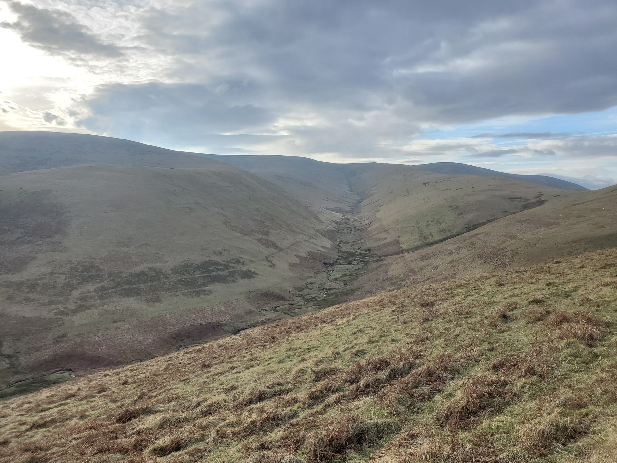 |
|---|
| Looking across the valley to a large, U-shaped valley draining the side of another hill in the distance |
I came this way on a previous walk I don’t think I wrote about, looking for several of the WW2 plane crashes in the Cheviots. A German plane came down on the slope below, but there’s no trace here now.
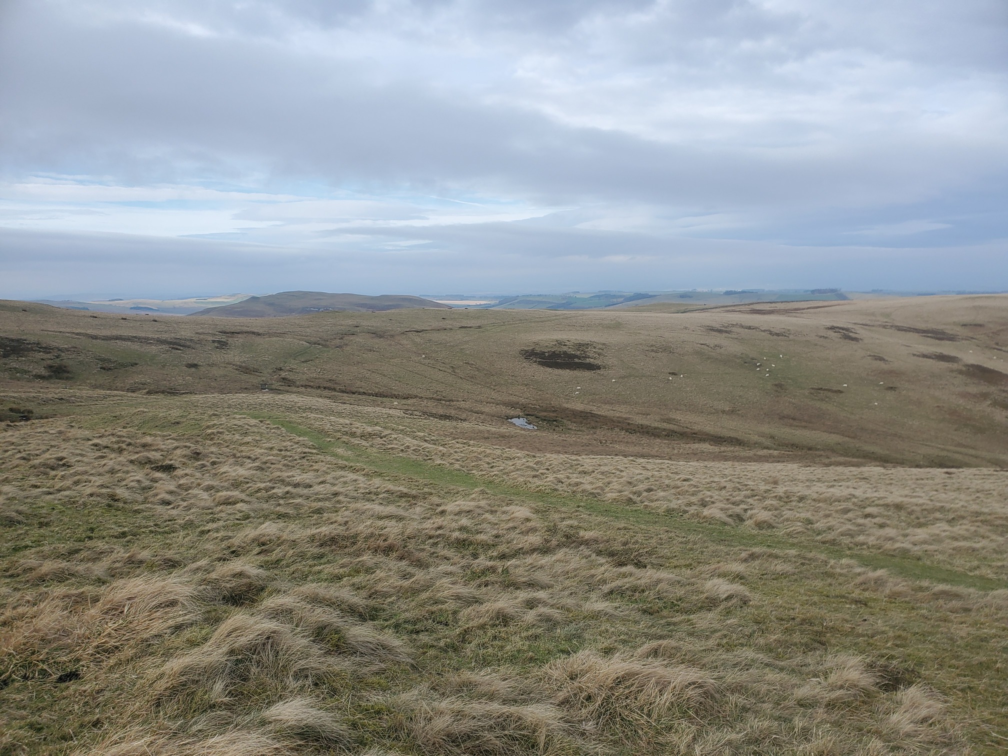
Then getting to the expanse of what used to be “Yetholm Common”. The first view is from Wideopen Head looking West, across an wet area marked as Maddie’s Well. This was Scotland in the 1860s OS Maps, but is now England
 |
|---|
| An area of greeny yellowy grassland, stretching away to the horizon. The ground slopes to a valley on the right, and behind a ridge in the distance are more hills. |
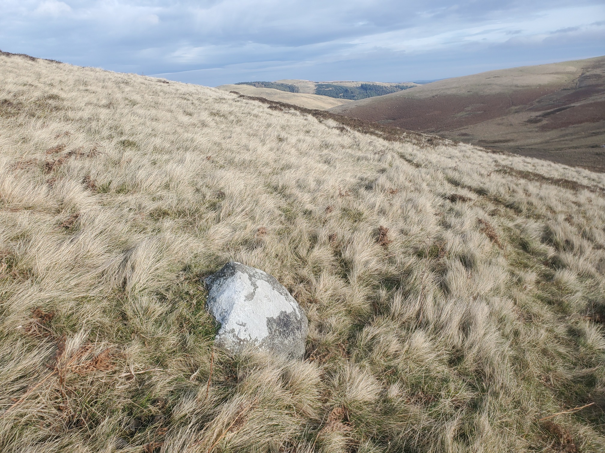
Down the slope is the site of the Two Gray Stones, but I don’t think there’s anything to see there and I didn’t fancy traipsing through bog. I did, however, walk to see Tuppie’s Grave. In the OS Name Book (that is, a book of placenames listed in the first OS survey, with evidence from local people to spelling and provenance) it is recorded as “This name applies to the grave of a “suicide” who hung himself about 60 years ago”. There was nothing at the grid ref given, I did find a groundfast rock about 120m away. Was this Tuppies Grave? And who was Tuppie?
 |
|---|
| A rock with patches of white lichen pokes out of the yellow grass on a hillside slope. |
From here I walked straight to the Stob Stones, now on the Scottish Side, previously this view from the current border wall to the stones was part of England. To my dismay the place was crowded, with a horde of two tourists already there. The Cheviots are just getting too popular these days. It’s out of control.
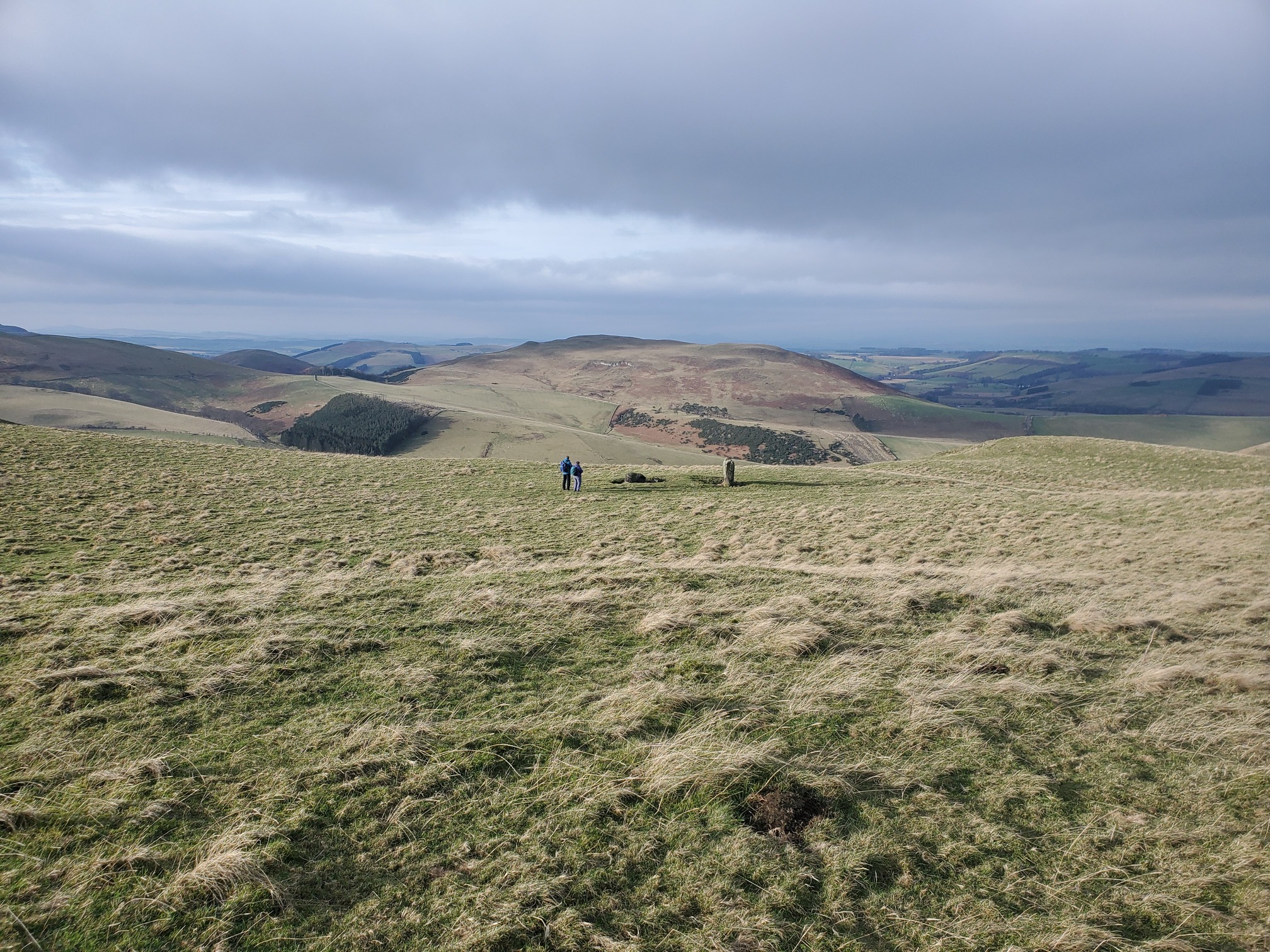 |
|---|
| Looking down a grassy slope, two figures stand next to a recumbant stone and a standing stone. In the distnace, various hills of yellow grass, brown heather and bracken, and a square of plantation. |
These stones are reputed to be where the “King of the Gypsies” was crowned. About 3km to the west is the village of Kirk Yetholm, where Scottish Gypsies had winter accomodation and a King - the Faa family, who had been given authority by King James V to “police and punish their subjects”. There is an excellent blog post about this community from Historic Environment, including use of the word “gypsy” in this context.
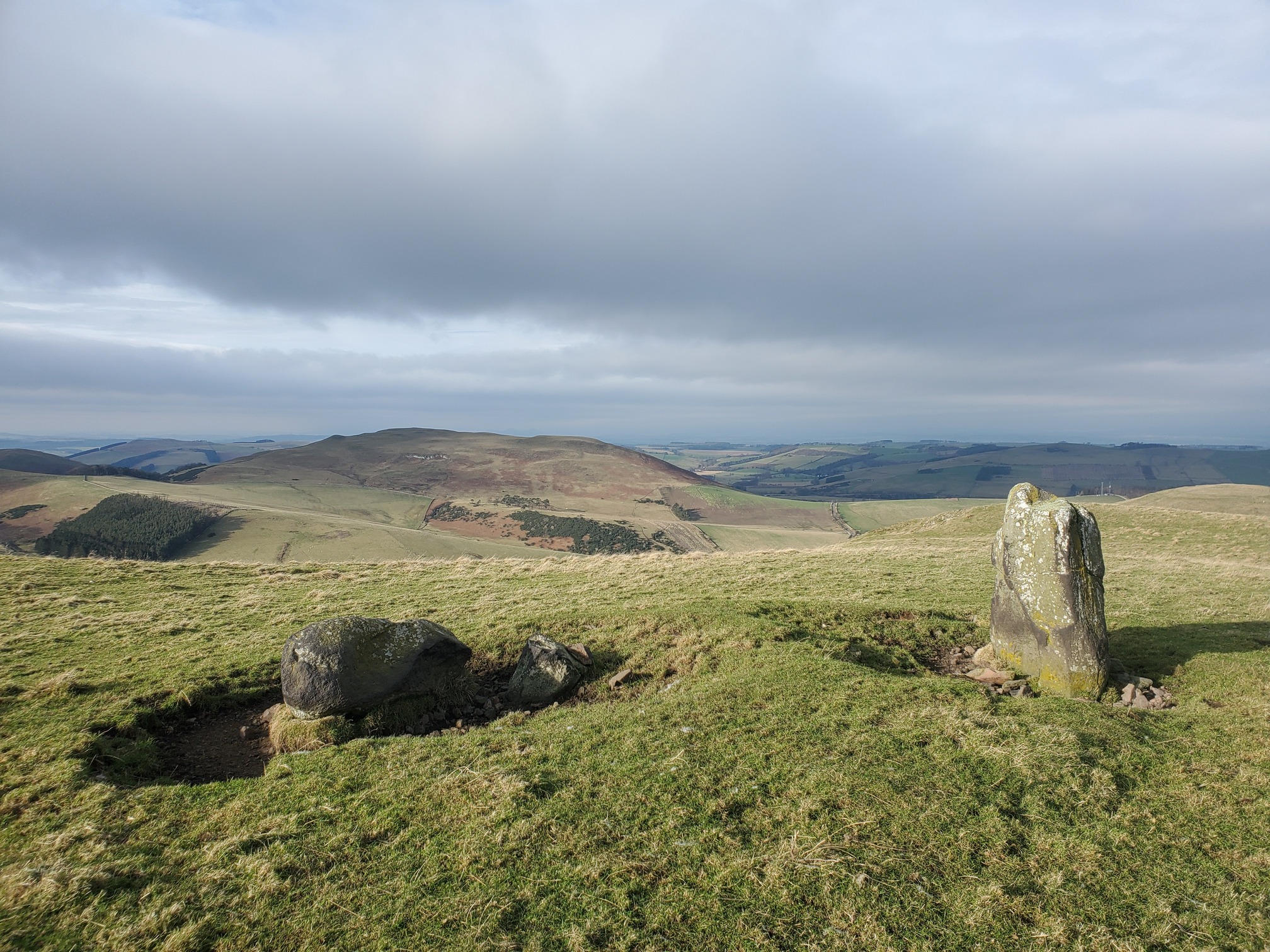 |
|---|
| A closer view of the Stob Stones |
From here, the old border crossed back to The Grey Stone, which is marked to lie on the current border “near Eccles Cairn”. Following St Cuthbert’s Way I crossed back into modern England, but I couldn’t see any large boulder, presumably at some point it was incorporated into the dry stone wall.
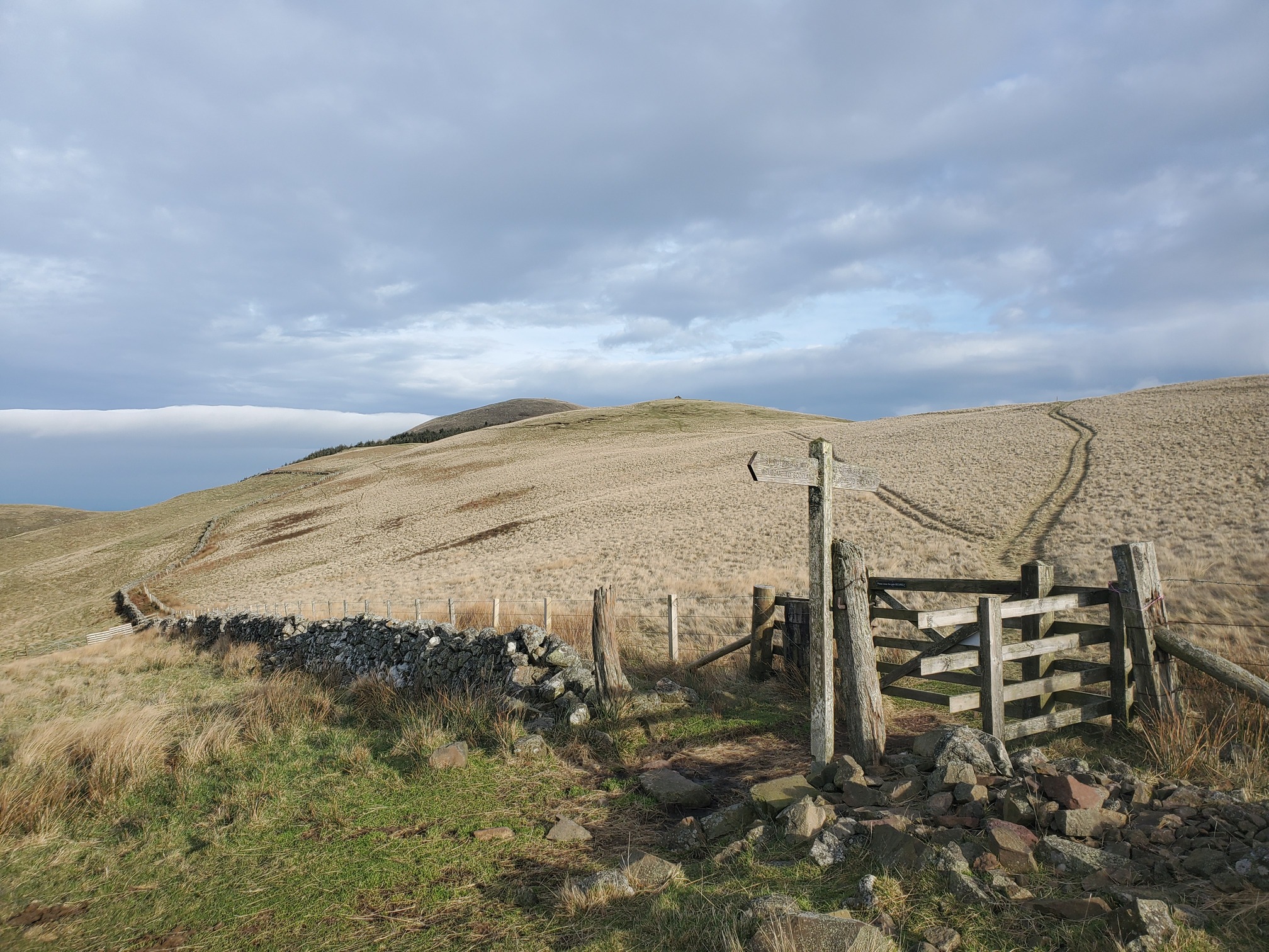 |
|---|
| A gate crossing a dry stone wall, with a wooden fingerpost by it. The wall curves along the side of the grassy hill, while beyond the gate two quad-bike tracks snake up the hill to the summit. |
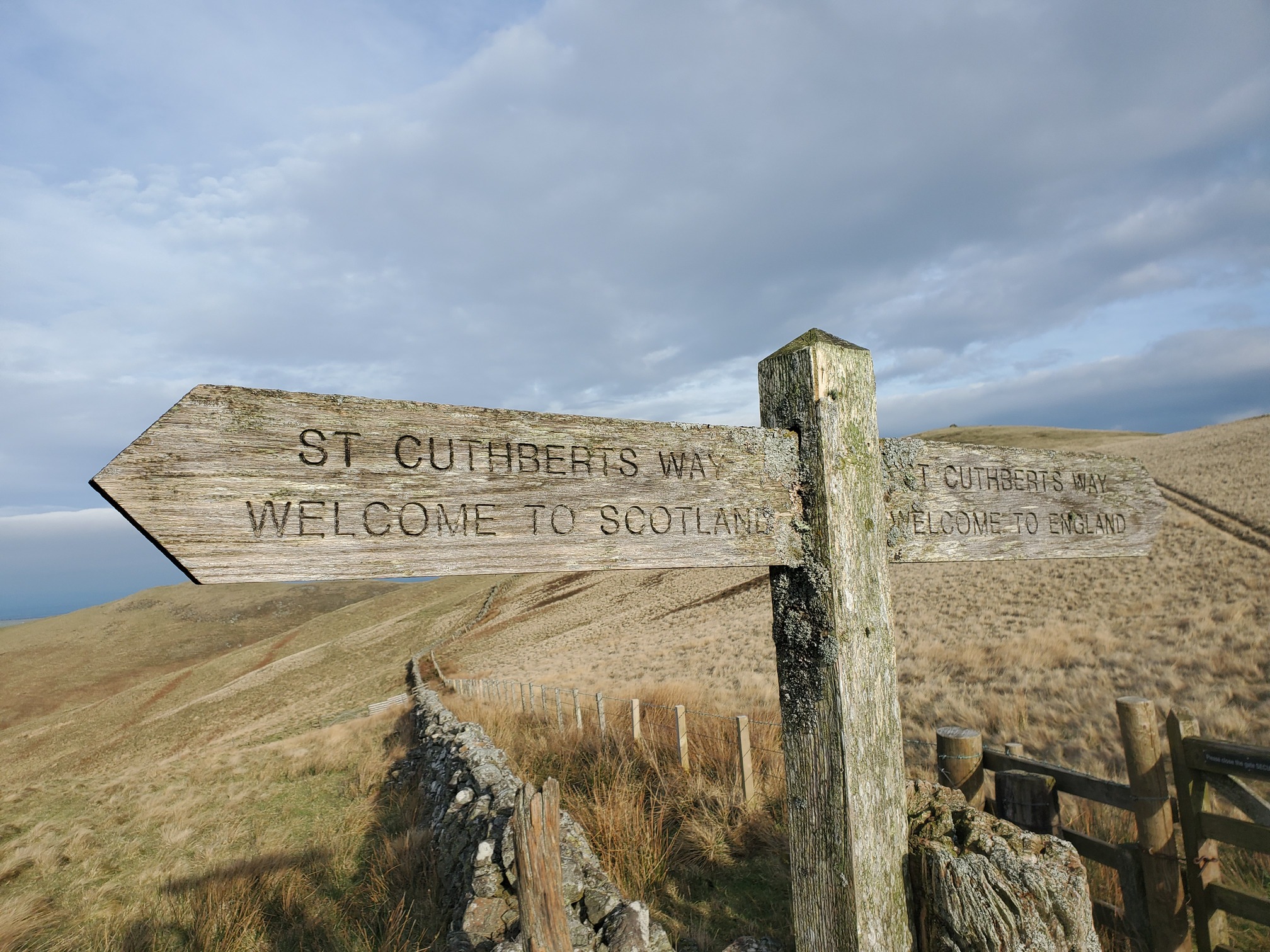 |
|---|
| A wooden finger post with two pointers in opposite directions; both say ST CUTHBERT’S WAY but underneath one says WELCOME TO SCOTLAND and the other WELCOME TO ENGLAND |
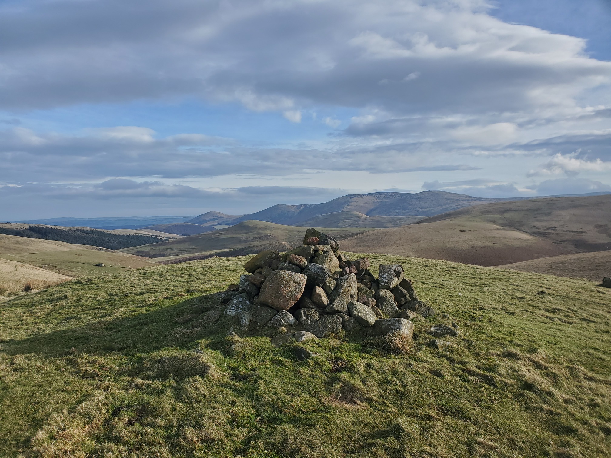
From here, I walked up to Eccles Cairn. I don’t know who Eccles was, I don’t think he was that lad in the Goon Show (one for the oldies there).
 |
|---|
| A stone cairn on top of a grassy hill. In the distance rolling hills under a blue sky with clouds. |
From here I followed St Cuthbert’s Way down to Elsdonburn Farm where I had wonderful views of a stoat in white ermine coat bouncing about the forest edge. I stopped to watch him for a few minutes until he noticed me, stood up on his back legs and looked at me then dove into the undergrowth. Magical! Almost made me wish I had a half decent camera.
| Map of route taken |