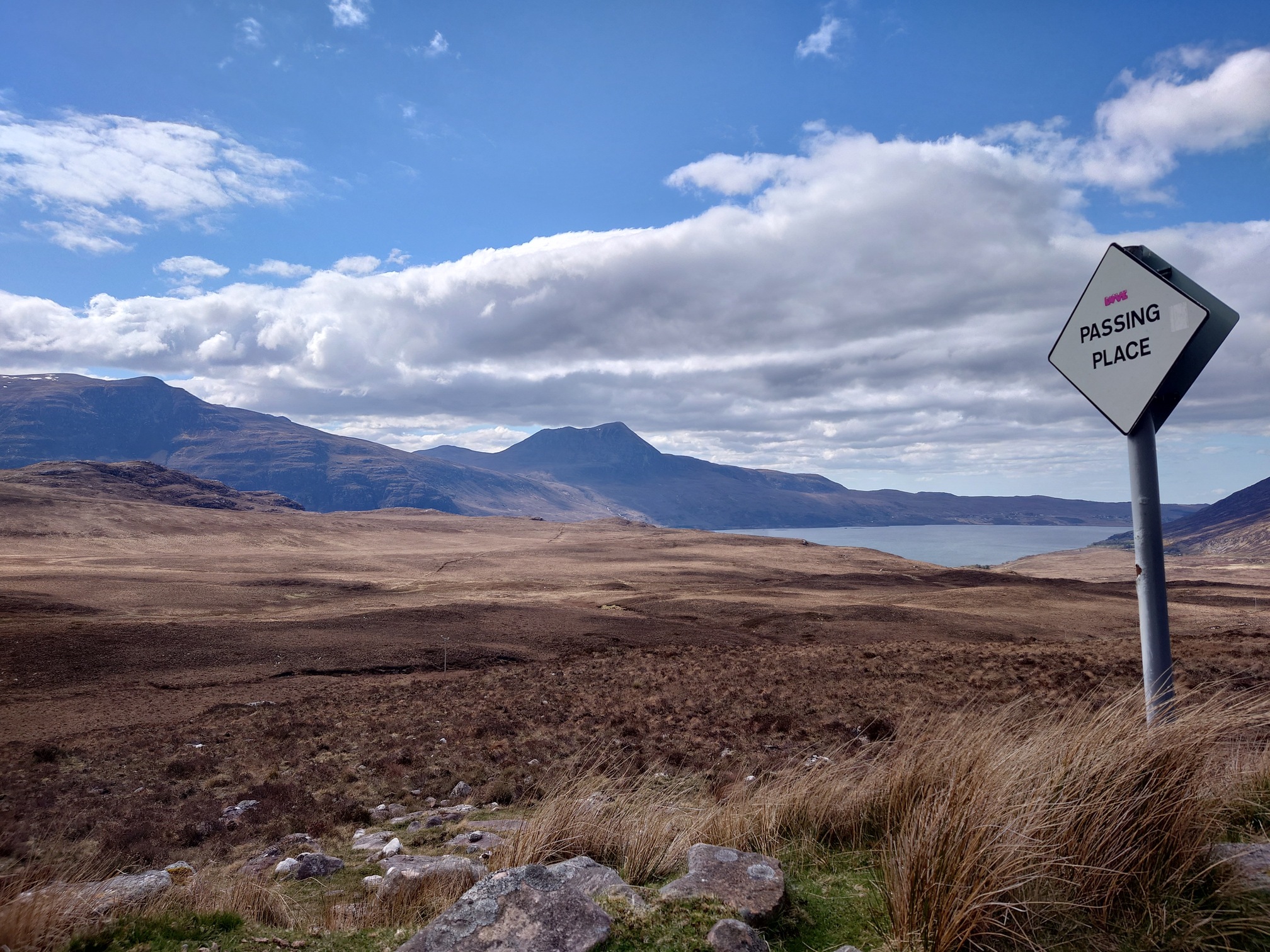
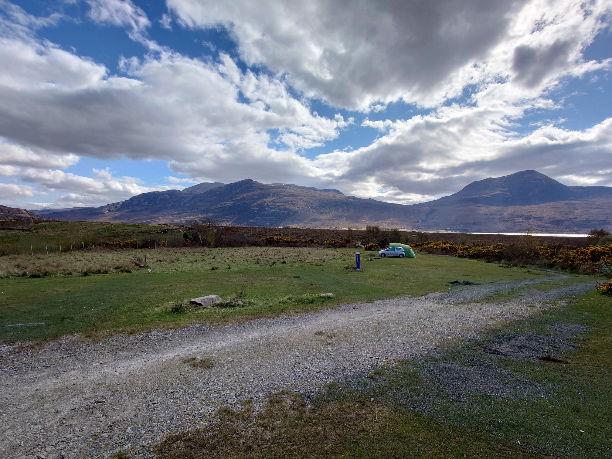
Had a few great days in Wester Ross at Dundonnell, the area between Torridon and Ullapool. I camped at Badrallach Campsite which I can’t recommend enough, half a dozen grass pitches, with indoor common room and a kitchen area in a little bothy, plus hot showers and toilets. Absolutely lovely quiet spot to spend as a base for a few days walking.
I had found some amazing multi-day walks in Richard Gilbert’s book Exploring The Far North West of Scotland which I really wanted to do, but I came down with flu that knocked me out for a few weeks so wasn’t sure what I was fit enough to do. Instead I thought I’d try a few long walks from a campsite, and drove north for 6 hours (with a nice stop with friends in Fife).
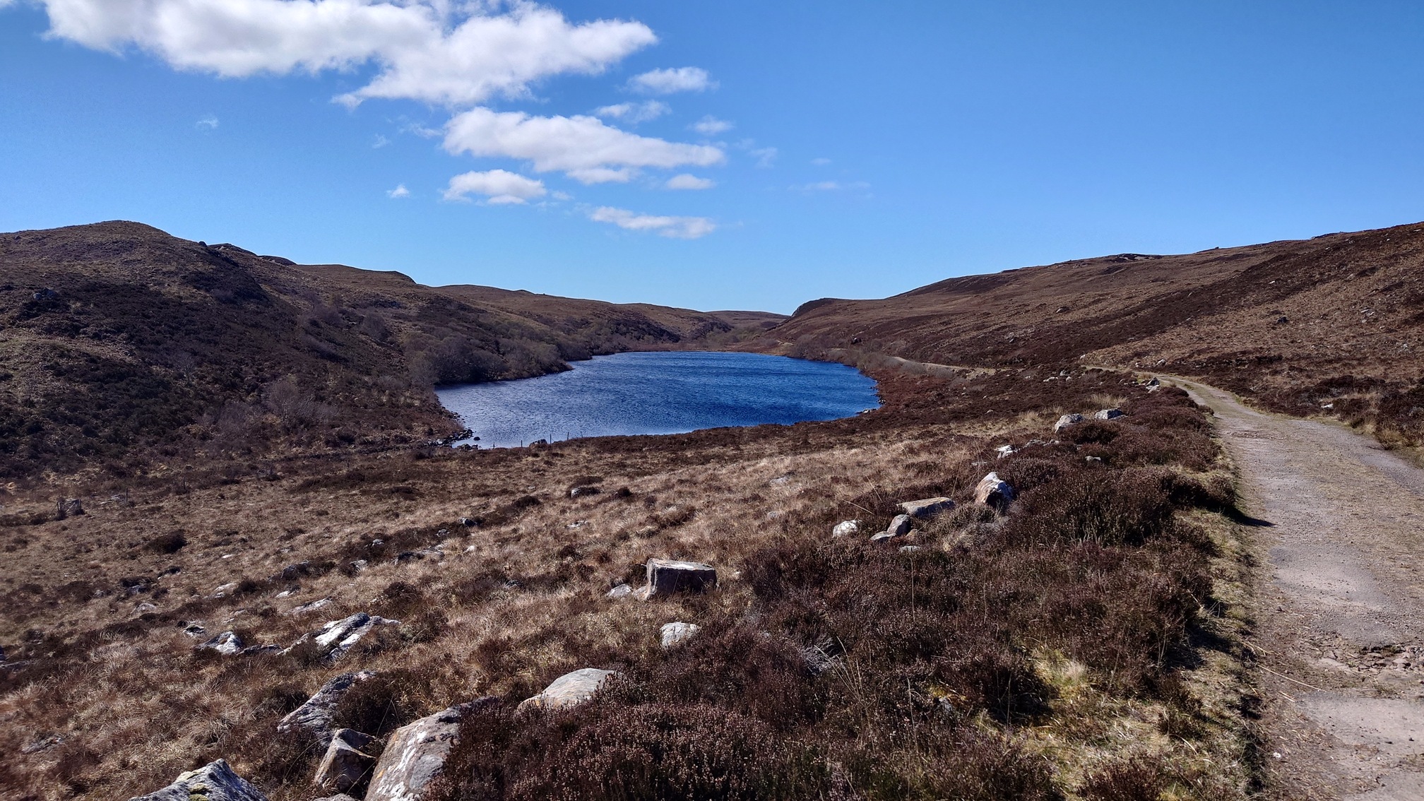
On the first evening it was just so wonderful I was keen to get out, so took a little evening walk along an old track and then up a steep slope to Loch na h-Uidhe halfway up Beinn Ghobhlach, which towers above the campsite. Five red deer stopped to watch me huff and puff up the slope, until I got to the loch and could enjoy eating a pear in the wind and sunshine and cracking views.
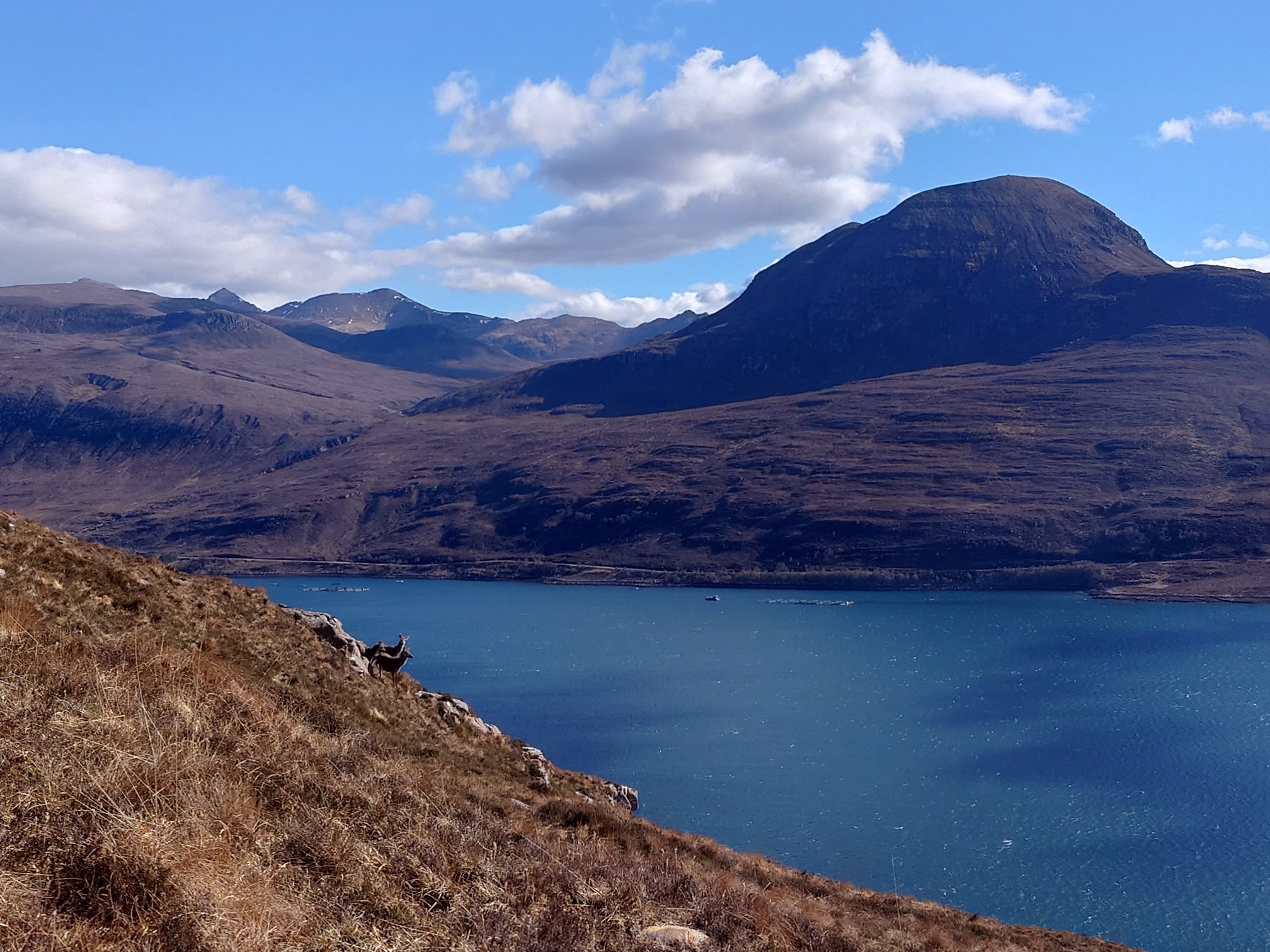 |
| Sail Mhòr from the slopes of Beinn Ghobhlach |
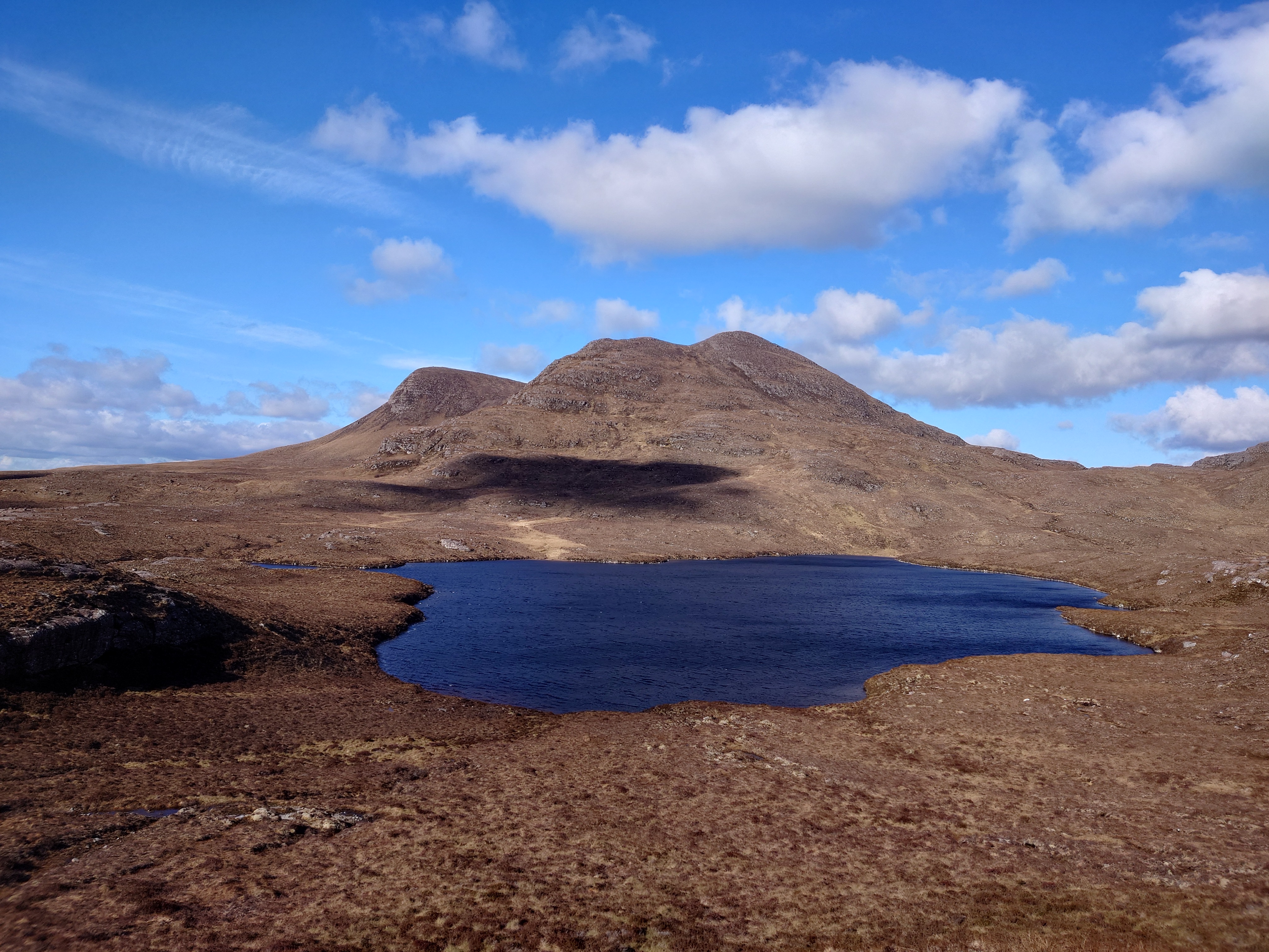 |
| Loch nn-Uidhe under Beinn Ghobhlach |
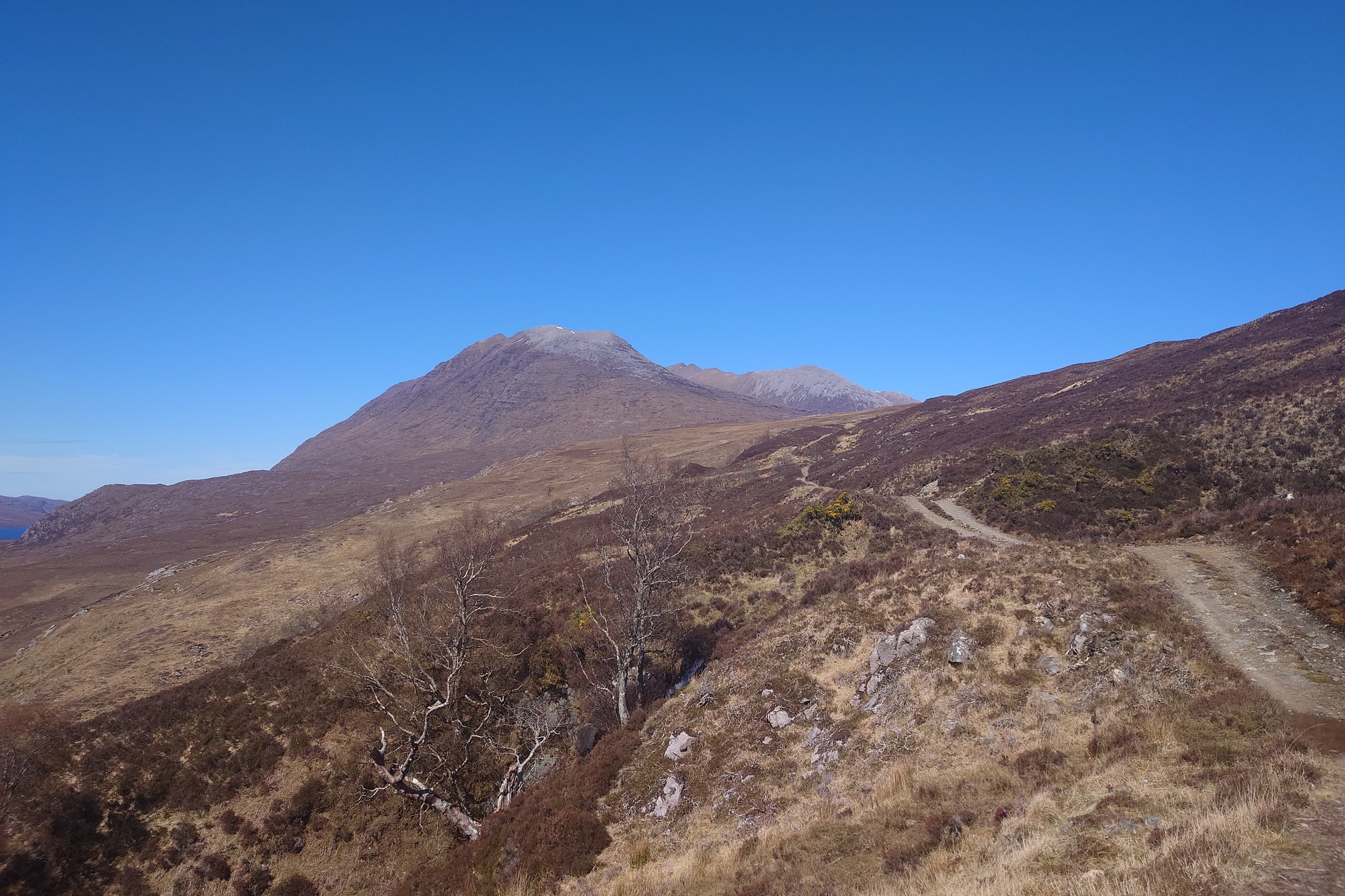
Back at the campsite, I didn’t feel too bad. I thought the next day I could get up early and climb An Teallach, the easy route from Dundonnell that doesn’t invole any scrambling.
The steep, rocky path led up and I took a left fork to follow the track up the Allt a’ Mhuilinn. I passed a man with camping gear descending. “Very windy up there!” he said as he bounded past.
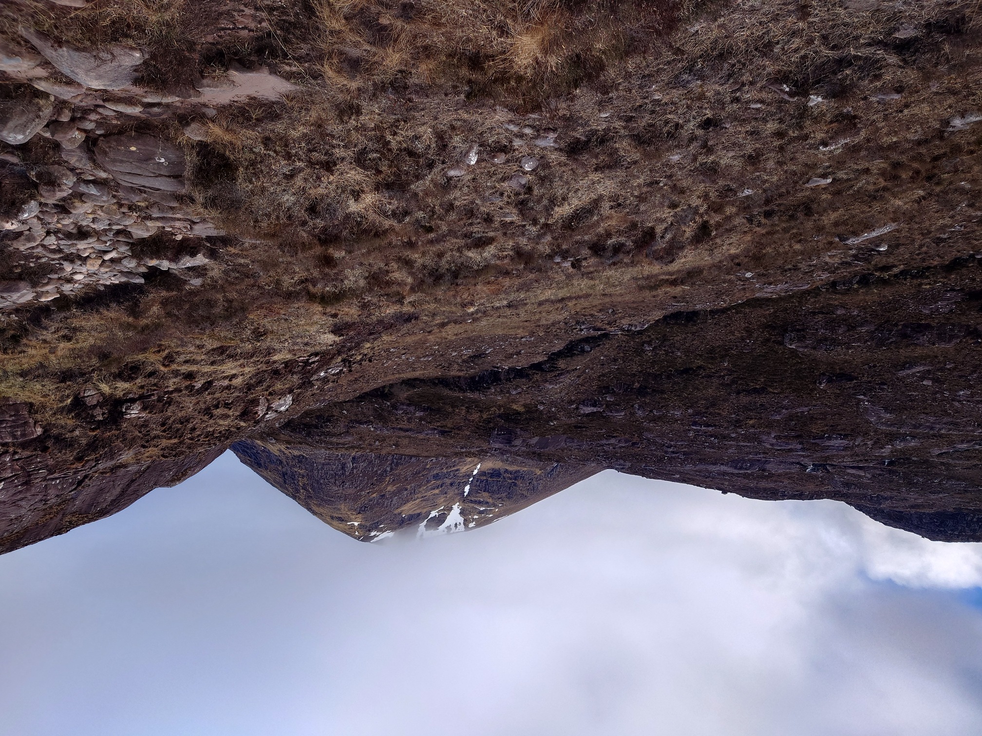 |
| Glas Mheall Mor in the cloud |
Further up the stream got more ravine-like and I reached snow patches. Eventually the path levelled out at a flat area of rock, I struggled to keep the path so followed little cairns around to start climbing Bidein a’ Ghlas Thull. Out of the shelter of the valley now, the wind was gusting powerfully as I stood very near the edge of a steep drop of several hundred metres. The path ascended into the cloud, so I made an executive descision not to spend the rest of the day alone in a cloud being blown off massive mountains. Beneath the cloud, however, the views I did see were spectacular.
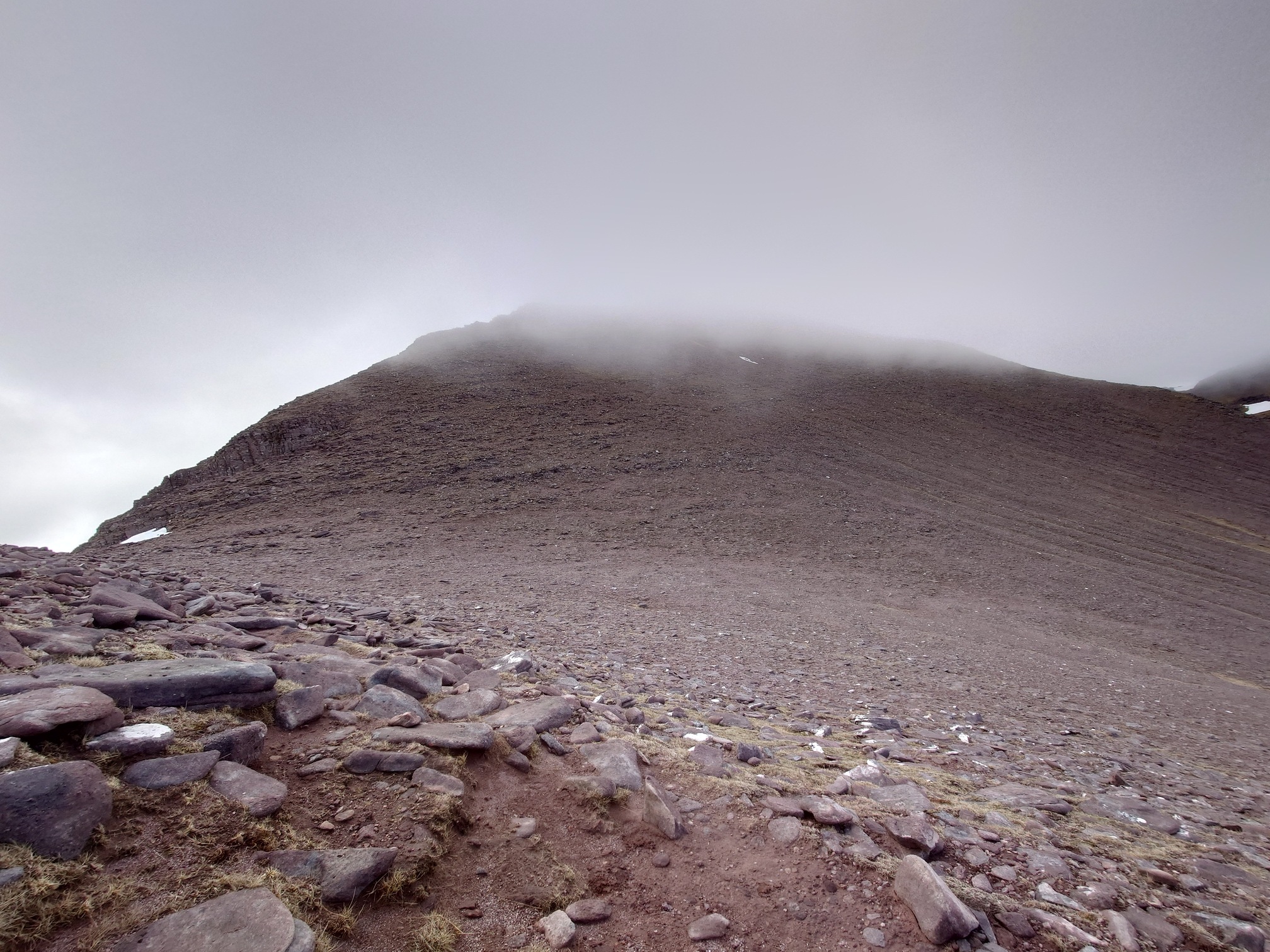 |
| Bidein a’ Ghlas Thull |
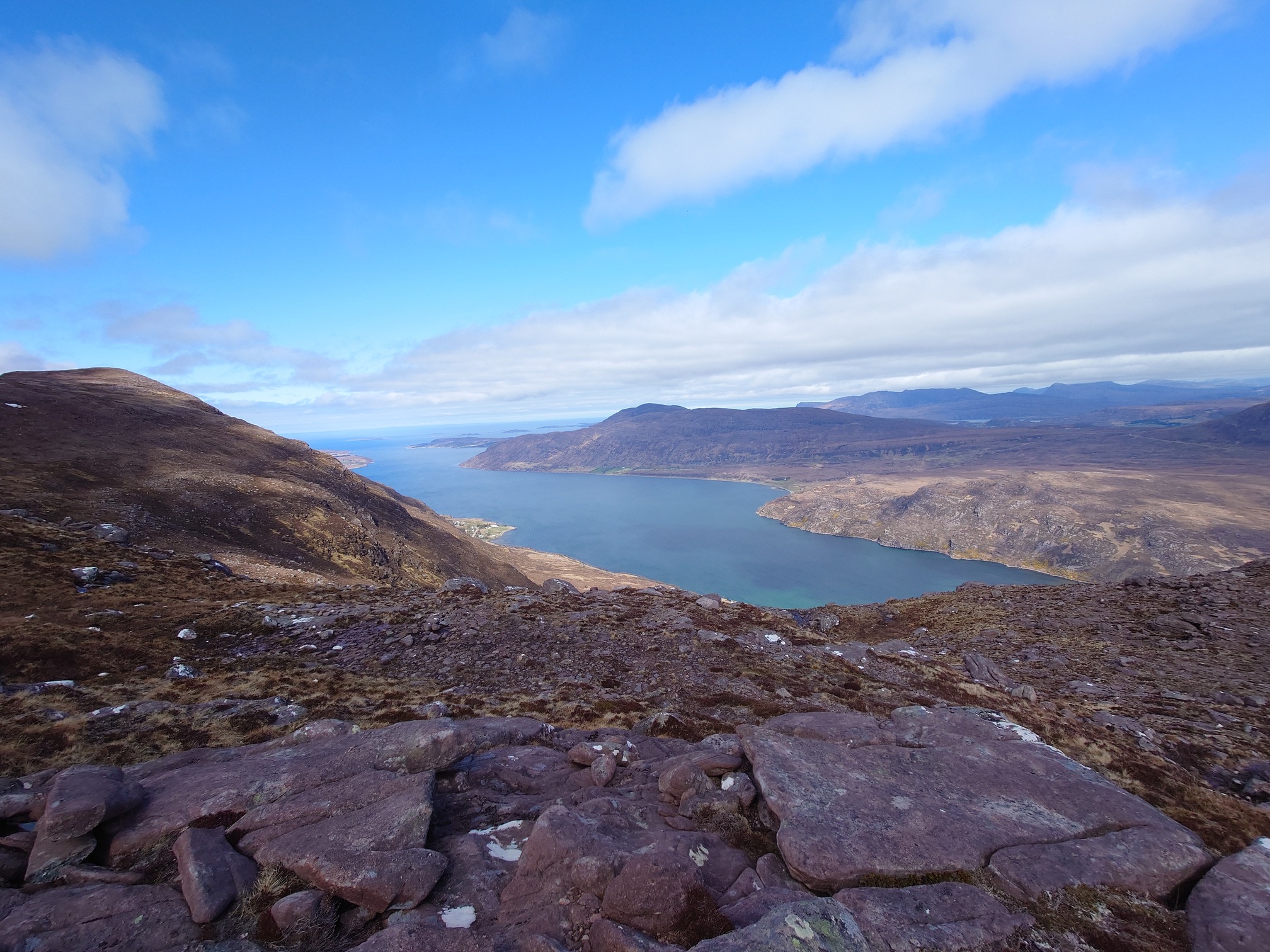 |
| Little Loch Broom |
I took a different route down, and of course by the time I got to the bottom the cloud had lifted. Still keen to see how far I could walk in a day, I drove round the coast and took a walk along an old road to Slaggan Beach.
 |
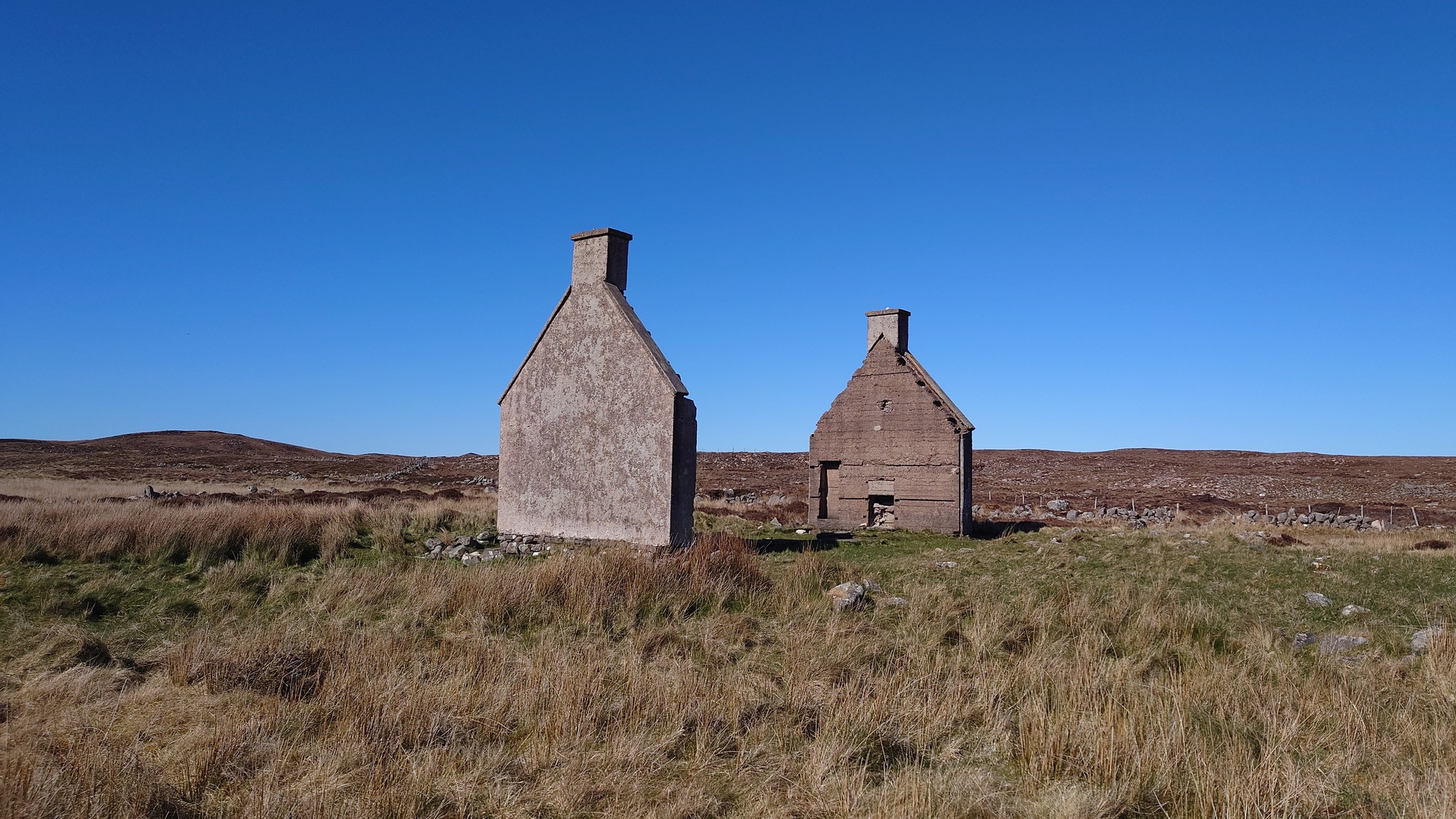
| the old road to Slaggan Village |
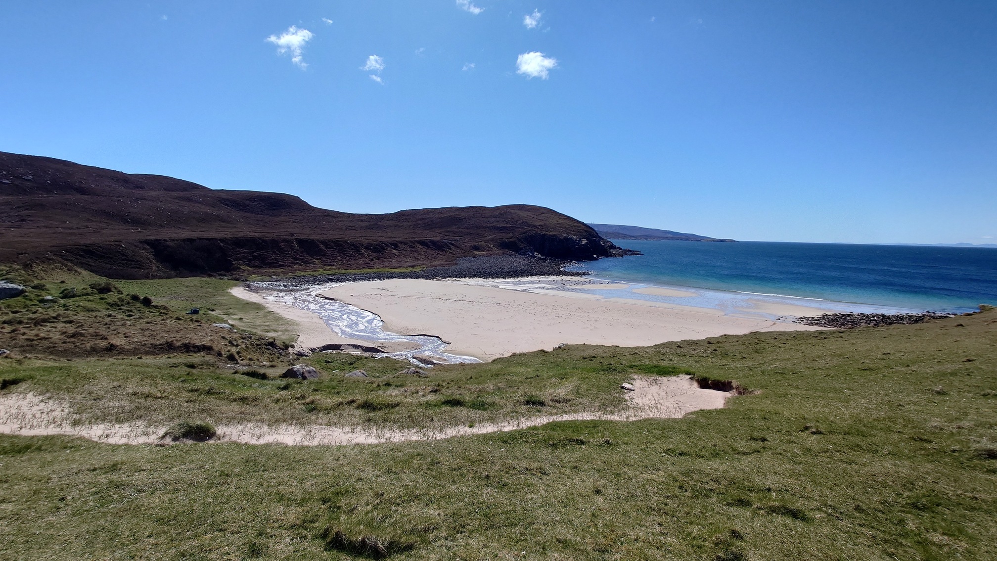 |
| Slaggan Beach |
This path was the road to the village of Slaggan. According to WalkHighlands, the village gradually depopulated until one family was left in the 1930s. In 1936 the Crofting Comission built them a new house, but a few years later it burned down and they left anyway.
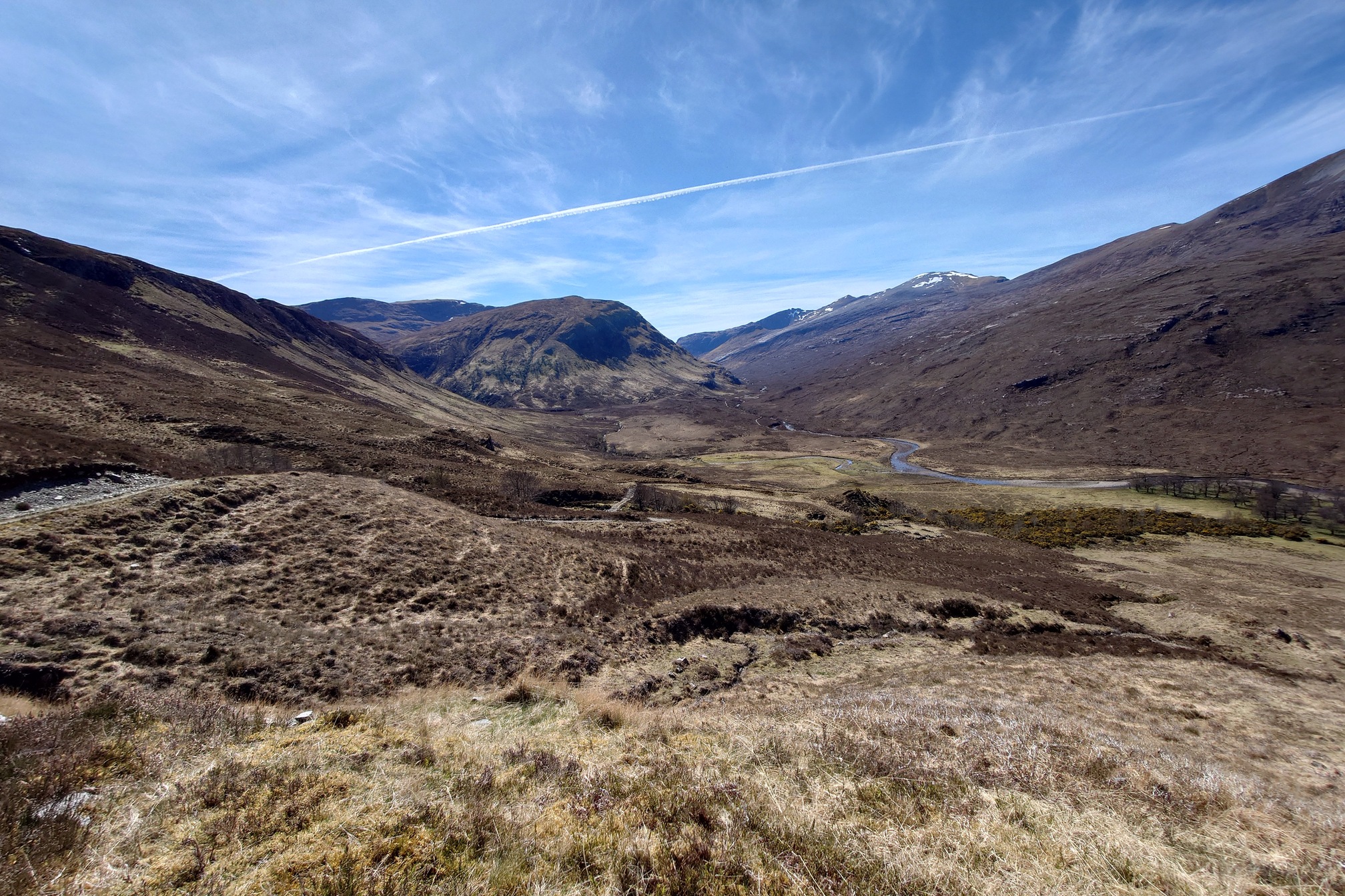
So in all a 20km day, the next day I felt great so took a longer walk, the Shenavall Circuit. This is the start of a couple of the epic multi-days into the “Great Wilderness” of Fisherfield Forest. It was a bright and lovely morning, as the path climbed up and over the lower slopes of Sail Liath, revealing absolutely beautiful views in the bright sunshine.
Dropping down towards Shenavall, I met with a group of 4 Germans who were hiking the Cape Wrath Trail. Wow! Yes, they said, we take one week on the trail and then have 51 weeks rest.
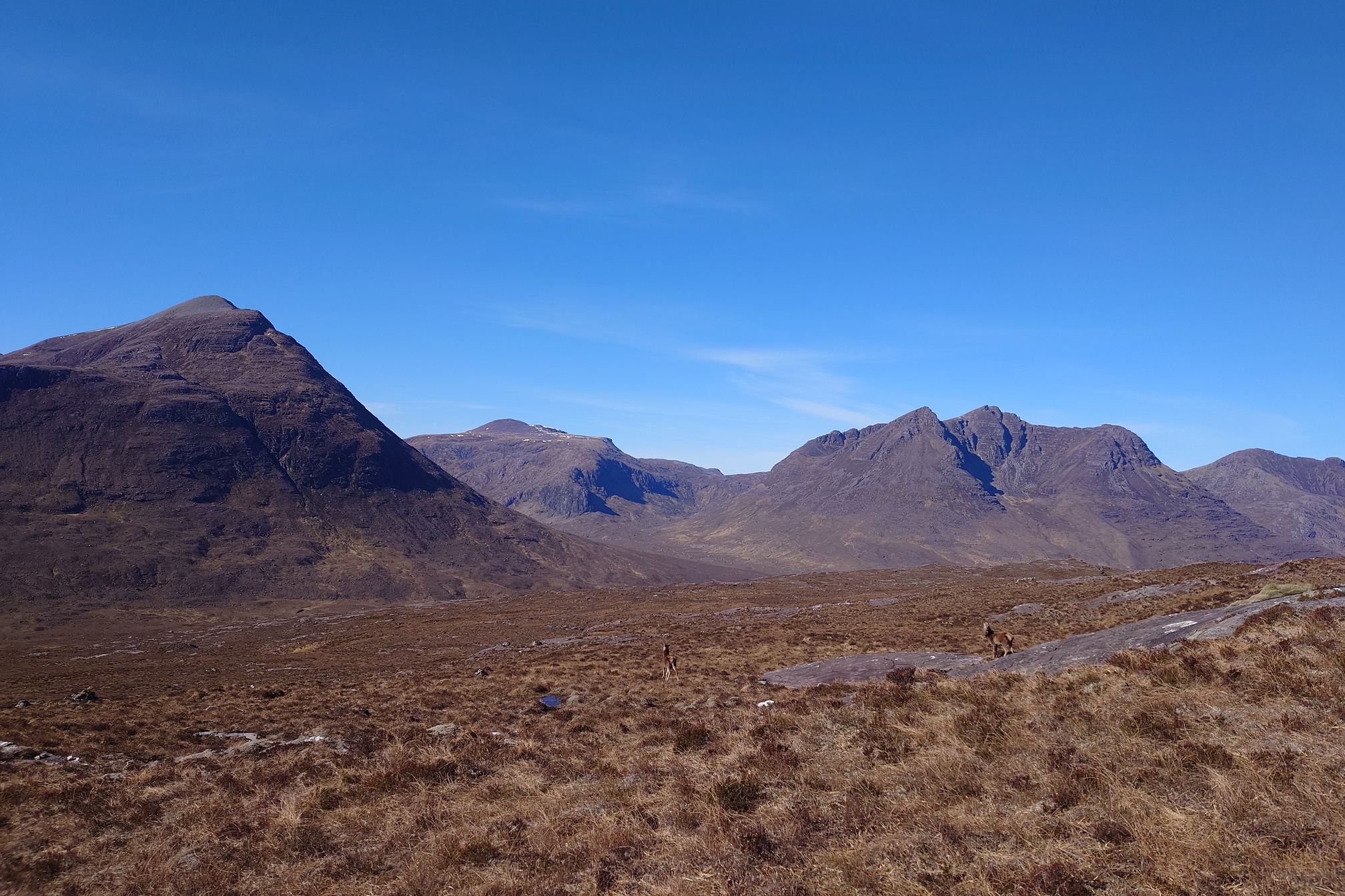 |
| View to the mountains of Fisherfield Forest |
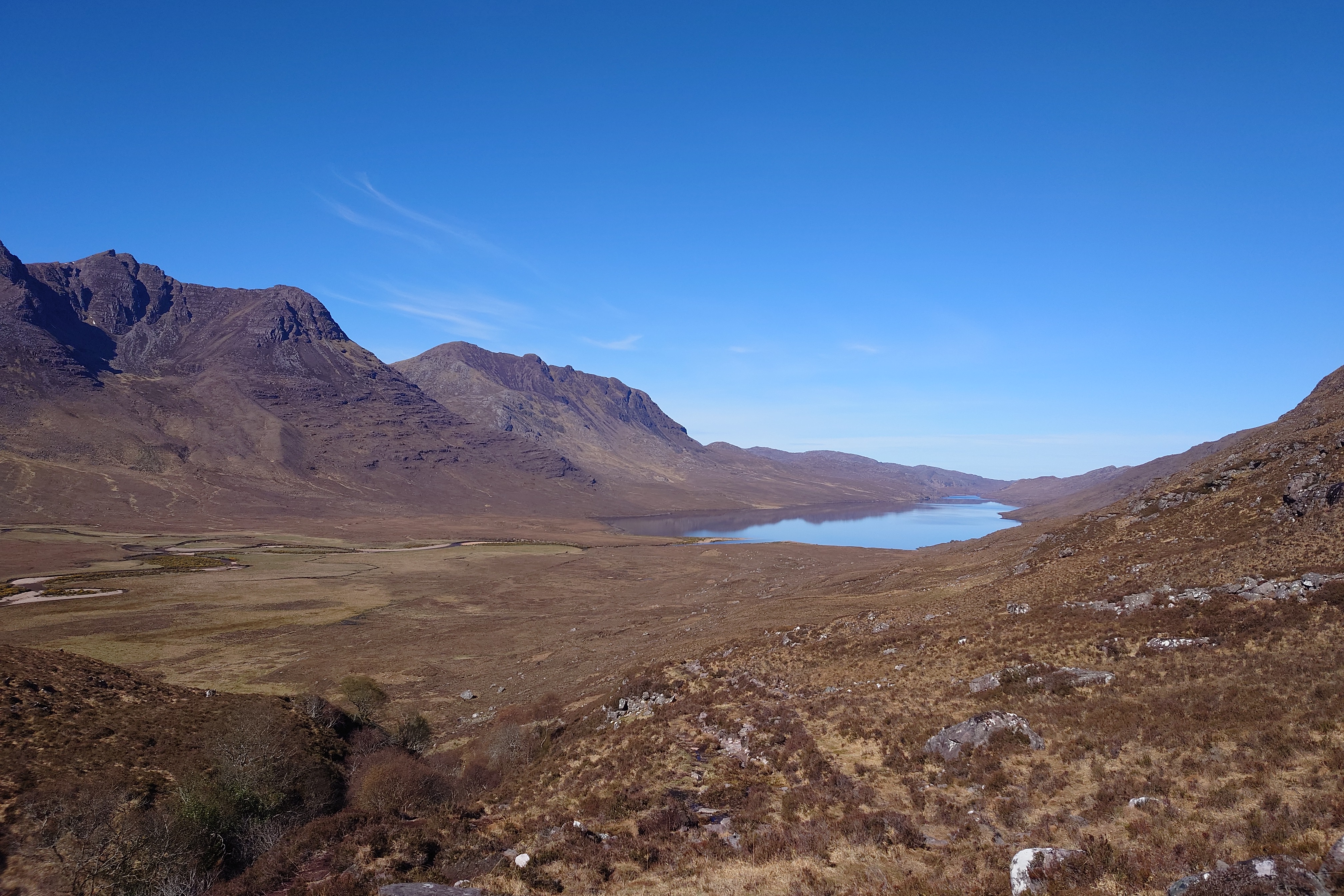 |
| Loch na Sealga |
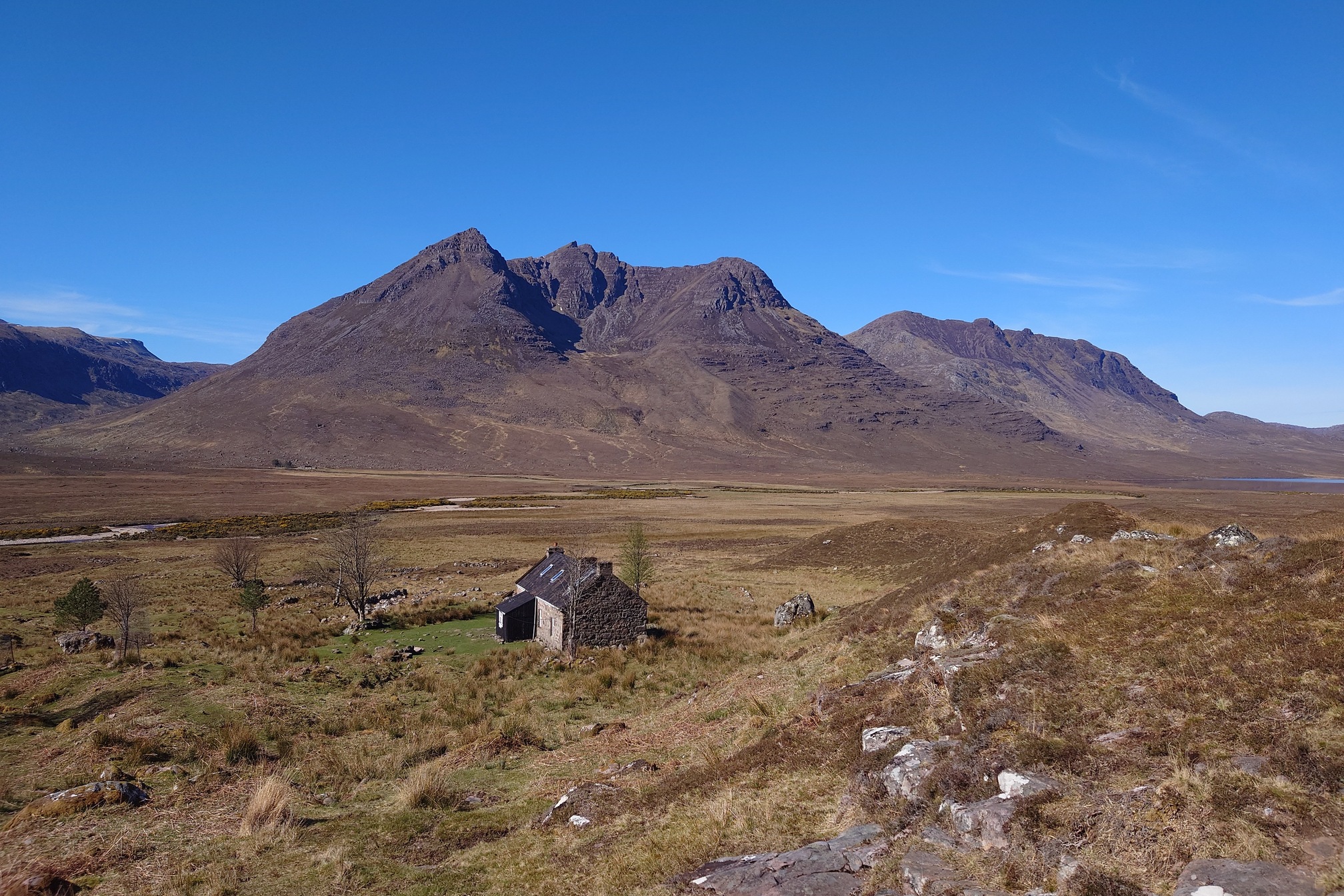 |
| Beinn Dearg Mhor behind Shenavall Bothy |
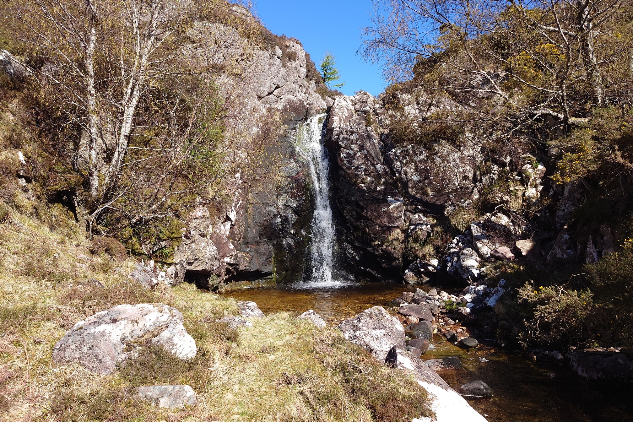
It had turned into a truly stunning day. I reached the bothy and thought about walking to the loch, but didn’t want to push myself too far, so carried on along the Abhainn Srath in the bright sunshine. I passed a hunting lodge by a waterfall at Achneigie, ate lunch under the shade of a tree, and passed through a lovely remnant of woodland, eventually the tracked turned and I began to climb back up.
Back on the top, the views were still incredible. What a great walk! About 22km in total, although I was kicking myself for not doing this walk on the previous day and going up An Teallach today instead. Oh well.
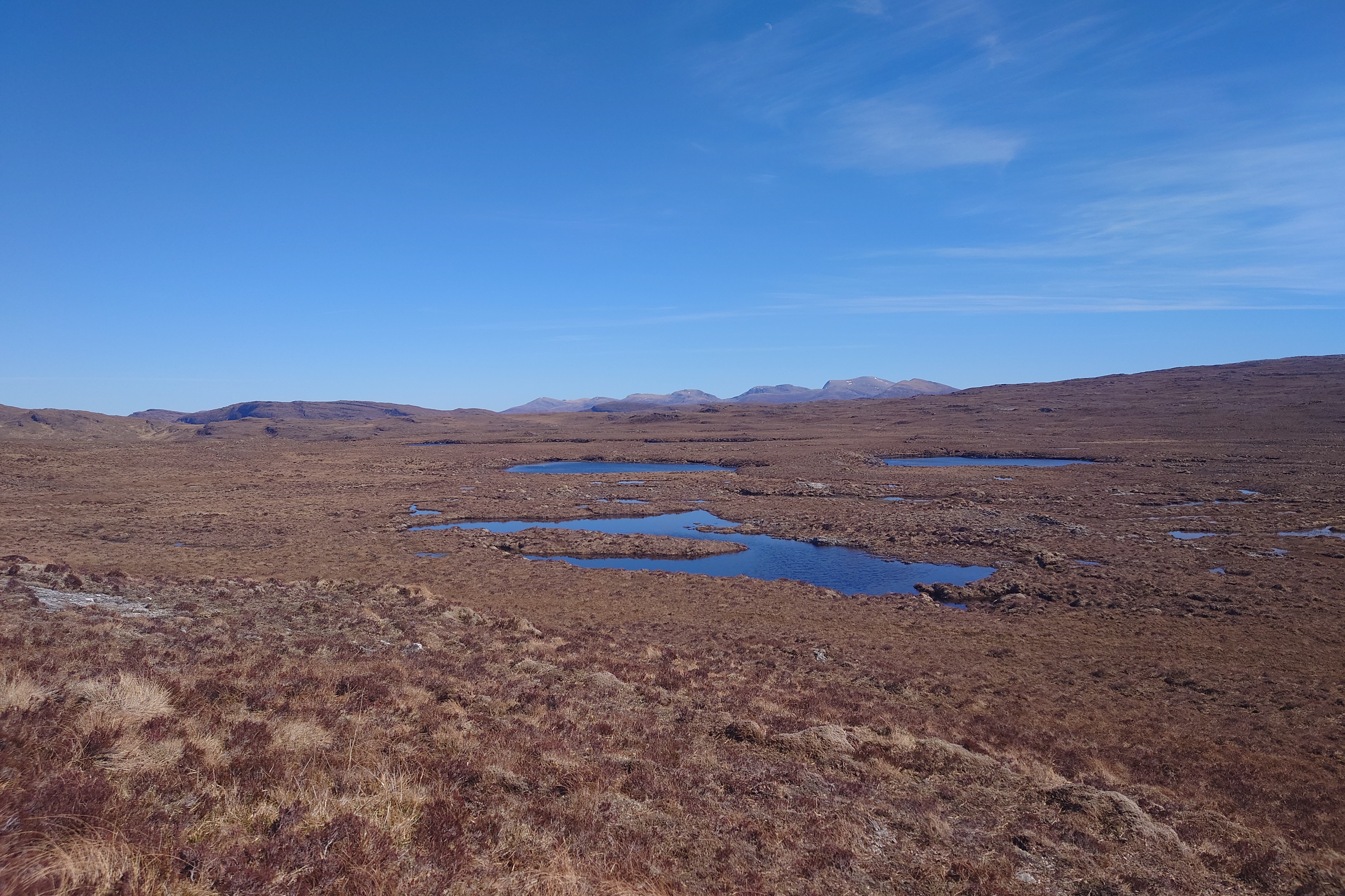 |
| Lochain Dubh and some small lochans on Dundonnell Forest |
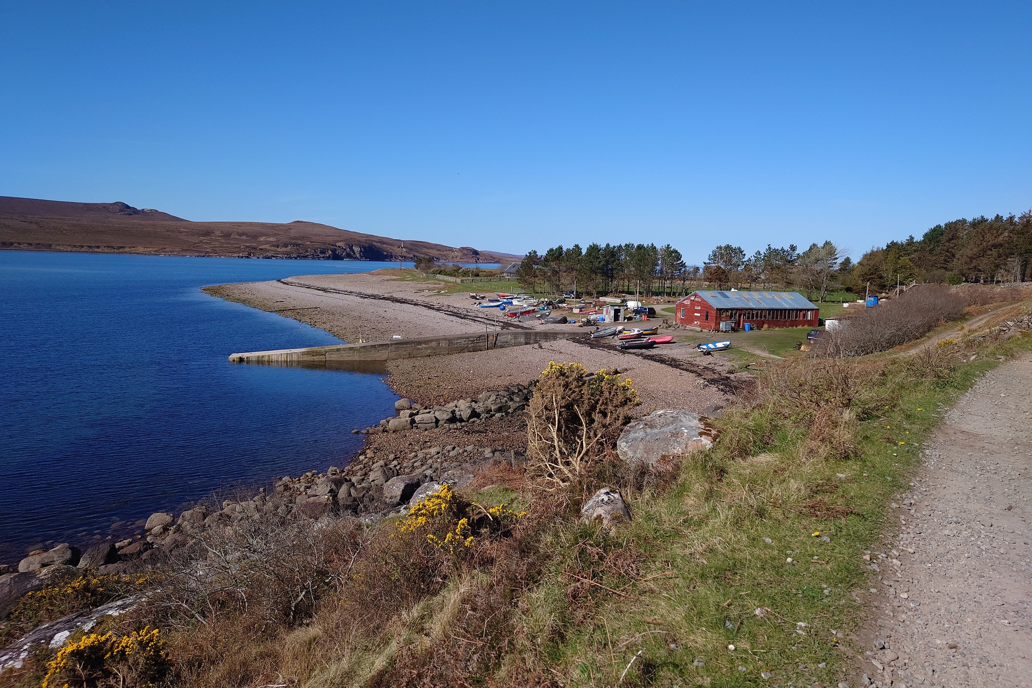
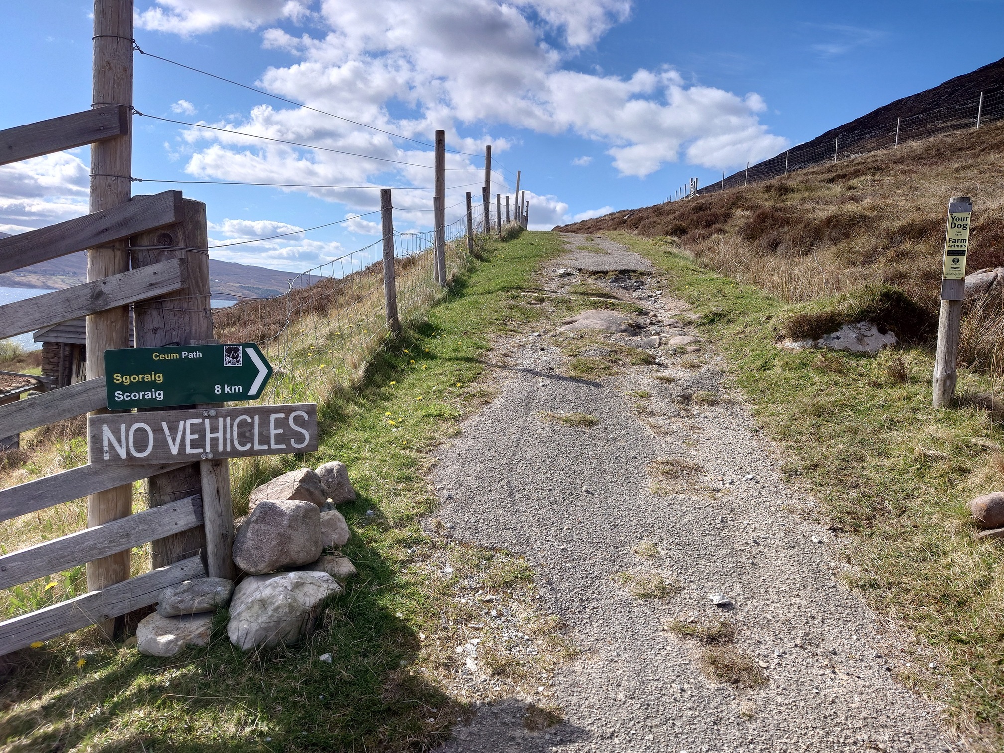
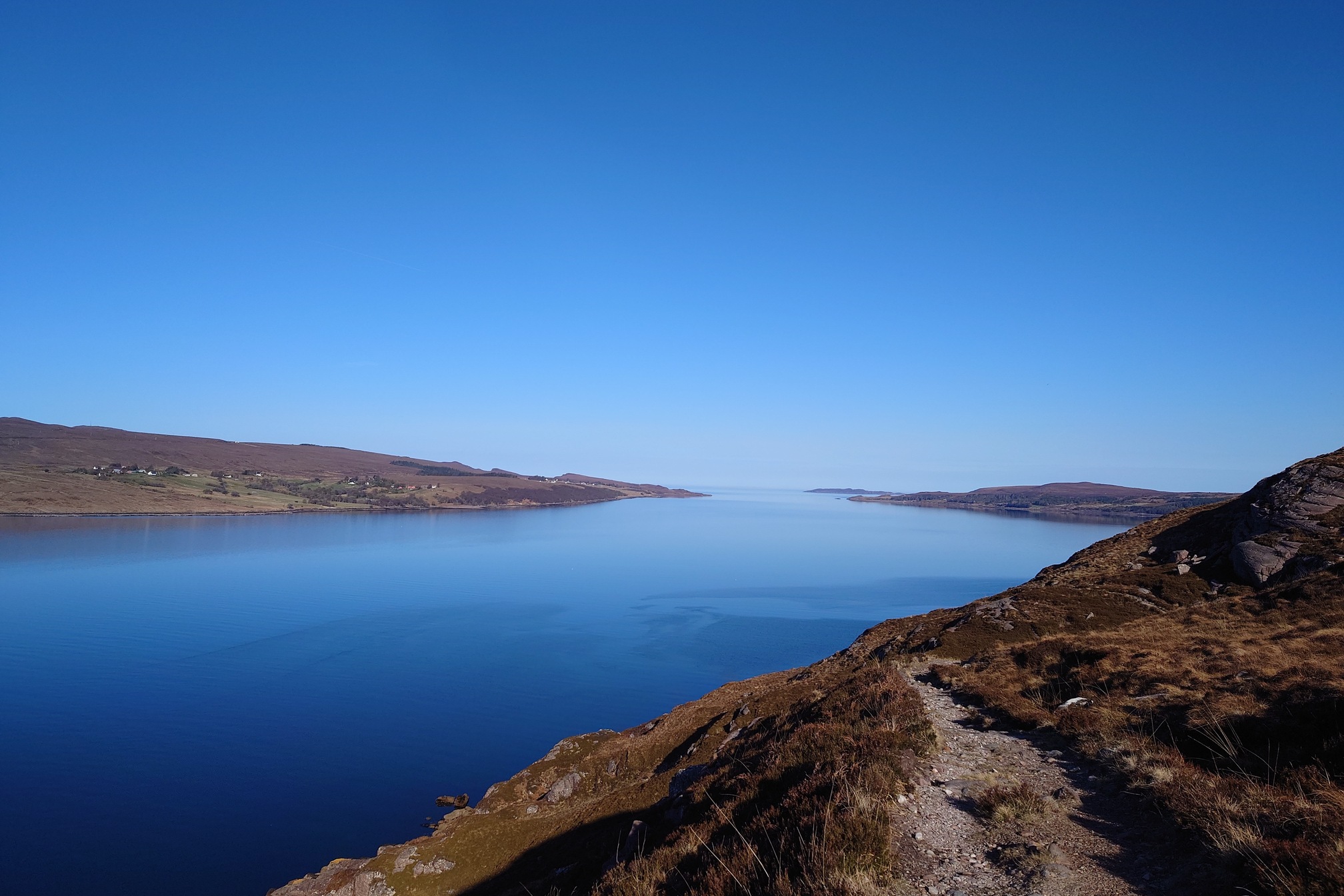
For the final walk, I wanted to visit Scoraig, 12km from the campsite along a cliff path, to a crofting community with no road access or mains electrics. It was a very cold night (I think it must have gotten down to below 5C as the cold woke me up) but the morning was chill and clear and promised a beautiful, hot day. I set off along what was the only land access to this village. Little Loch Broom was mirror calm and crystal clear, and as I watched Great Northern Divers far out in the distance, I also noticed something swimming closer to the cliff edge - an otter! I also could see seals and the water was clear enough to watch them turning and twisting under the surface.
 |
 |
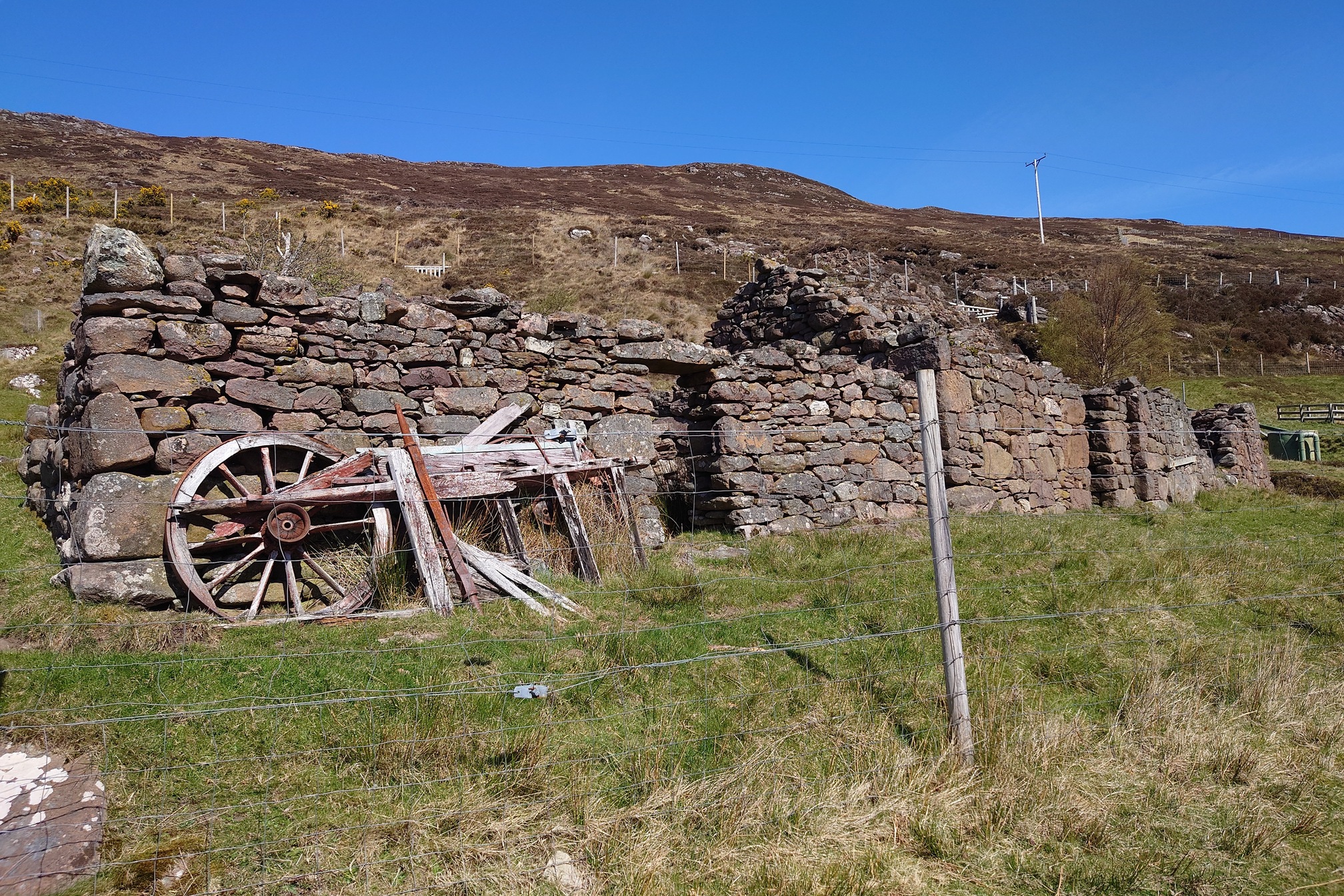
Scoraig itself is a working crofting community, houses and smallholdings scattered across the landscape. A little lighthouse in the woods has an interesting display of information boards about the community and its history, but there’s not much else there for a visitor - unsurprisingly, I doubt they get many tourists! A lot of the houses seemed to be very new and well-made eco houses, while I think I had been expecting it all to look a bit more ramshackle and DIY. I walked down to the harbour and ate a pear, then headed back.
The weather still glorious, I hiked back to the campsite and packed up as I’d planned to visit friends in Dundee, which was also very lovely, although I could quite happily have stayed longer in Wester Ross, particularly in that fine weather. In total I walked about 70km in three and a half days, which sounds about right and I think I could now manage multiday walks again. What a great place though! I will definitely be back, if only to climb An Teallach.