Buckham’s Walls
Today up to the very top of Coquetdale for a look at some ruins and a walk along the Border. Upper Coquetdale farms are excitingly in the process of finally, in the year 2026, getting connected to the mains electrics, and as a result heavy machines have been up and down the valley and the road is absolutely knackered with potholes. I parked up just past Blindburn and followed the Buckham’s Walls Burn, first to where it is joined by Remmies Burn.
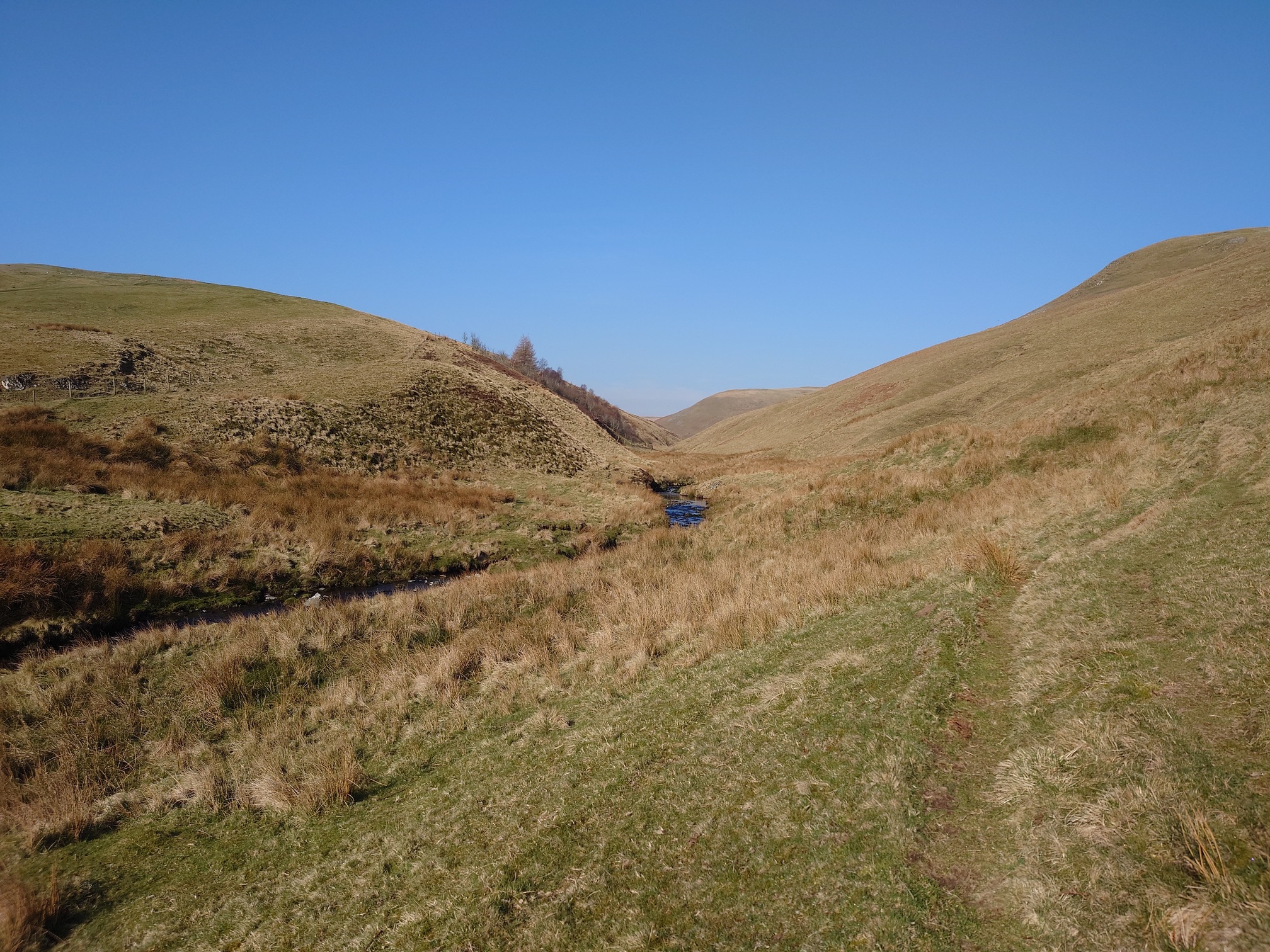 |
The excellent book “The Old Track Through The Cheviots” by David Jones and Coquetdale Community Archeology has a lot of info on archeology in this area. It’s well worth picking up if you can find it. In the book, they highlight several historic farmsteads lost to the mists of time and the oblong ruins here may very well be one of them.
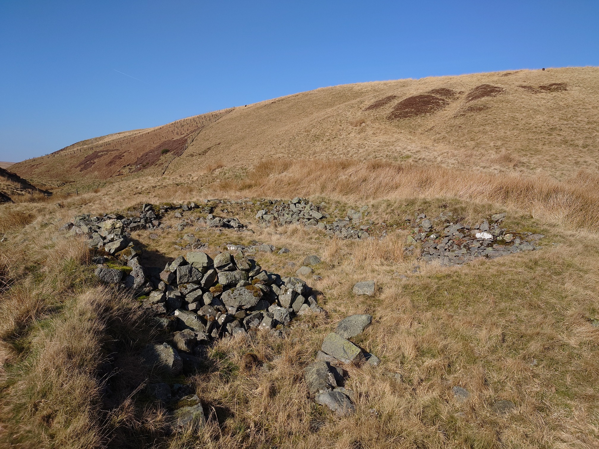 |
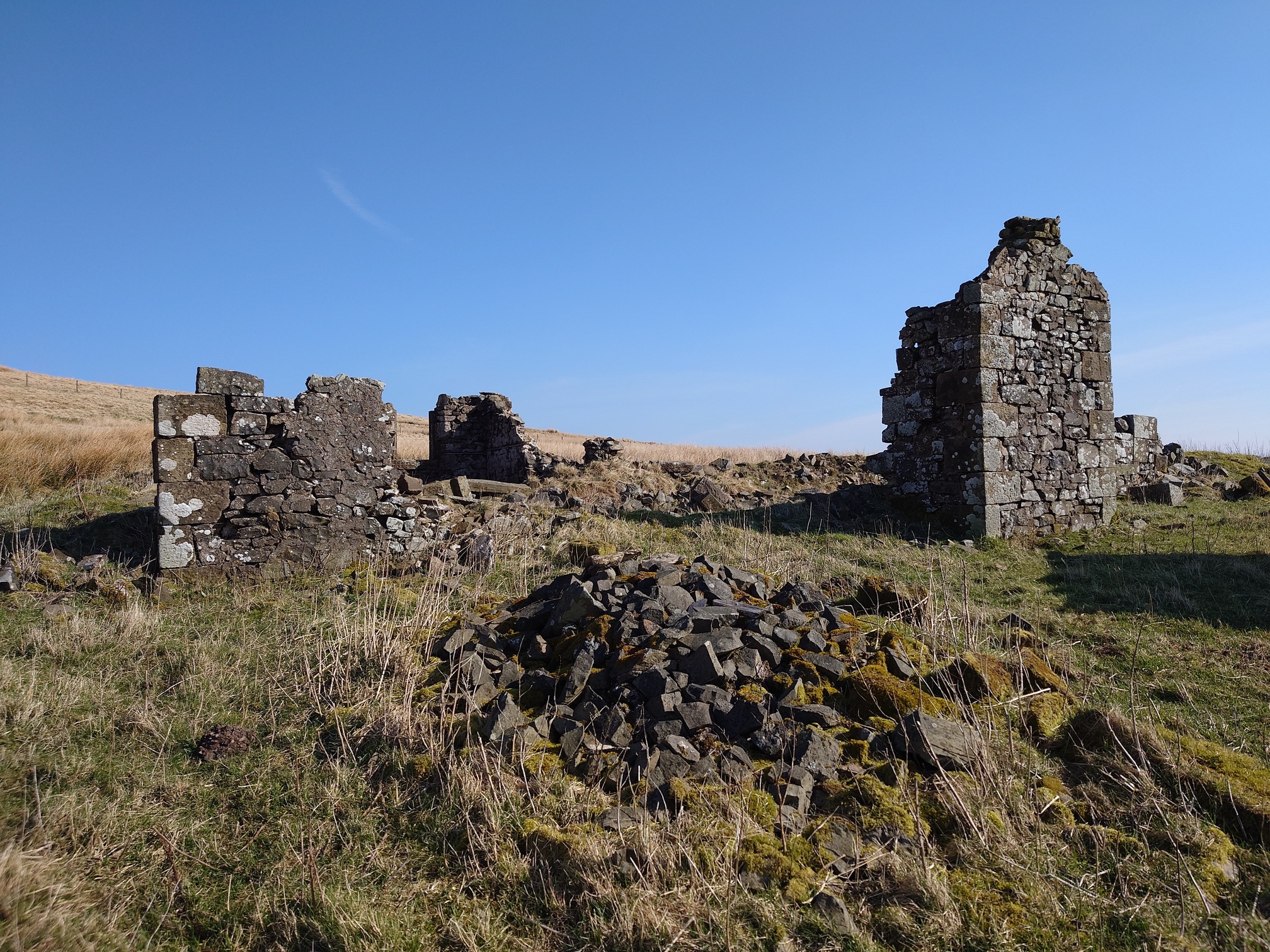
From here, I climbed up a little way to reach the ruin of Buckham’s Walls. This was another very isolated shepherd’s cottage, and like the others in the region, probably abandoned sometime around WW2.
 |
In the 1841 Census at Buckham’s Walls, this tiny house held an impressive eight members of the Lilico family; Hugh and his wife Helen, and then their six children aged between 0 and 18, including 15-year-old twins and a nameless one-month-old.
In the Northumberland Name book, produced between 1858 and 1864, a Mr G Turnbull lives here. He is one of three men, the other being Mr George Telford of Blindburn, and Mr John Telford of Barrow Burn, who give authority to the spelling, and the name book describes it as “A Small dwelling house with garden &c attached. Occupied by a shepherd.” and indeed in the 1861 census George Turnbull, the shepherd, lives here with his wife Elizabeth, and five children under the age of 10.
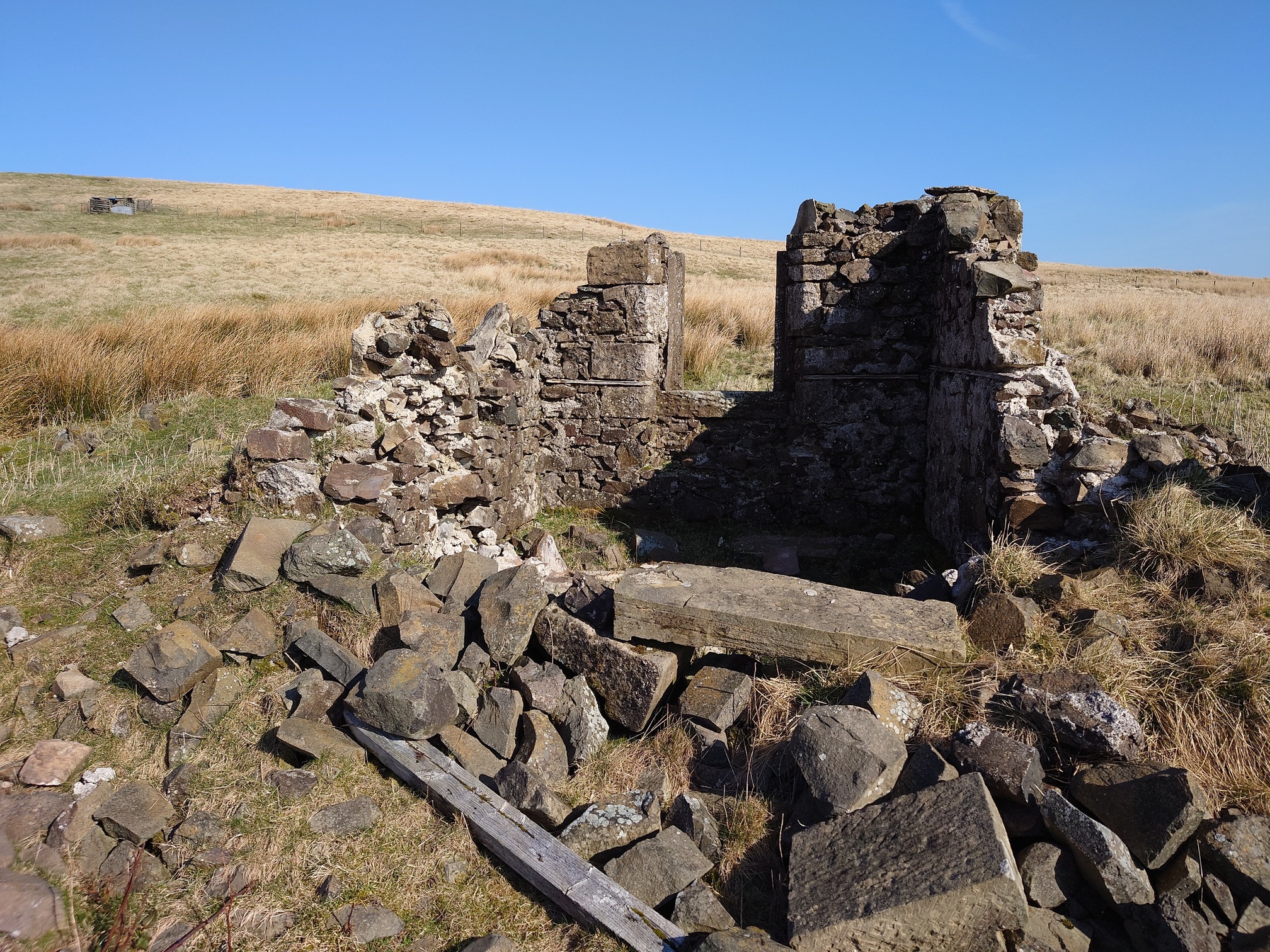 |
The British Newspaper Archive has John Little looking for a shepherd in 1941, while the Jedburgh Gazette in 1950 lists it as derelict and having been vacant for nearly 10 years. John Little died in 1944, and Jones’ book suggests the building was probably abandoned not long after. The book includes some pictures of the ruins in the 1990s when it was still roofed; now little is left standing. There’s also a fantastic collection of pictures at this website of scans of slides of Coquetdale, including this one of Buckham’s Walls when it was still being farmed.
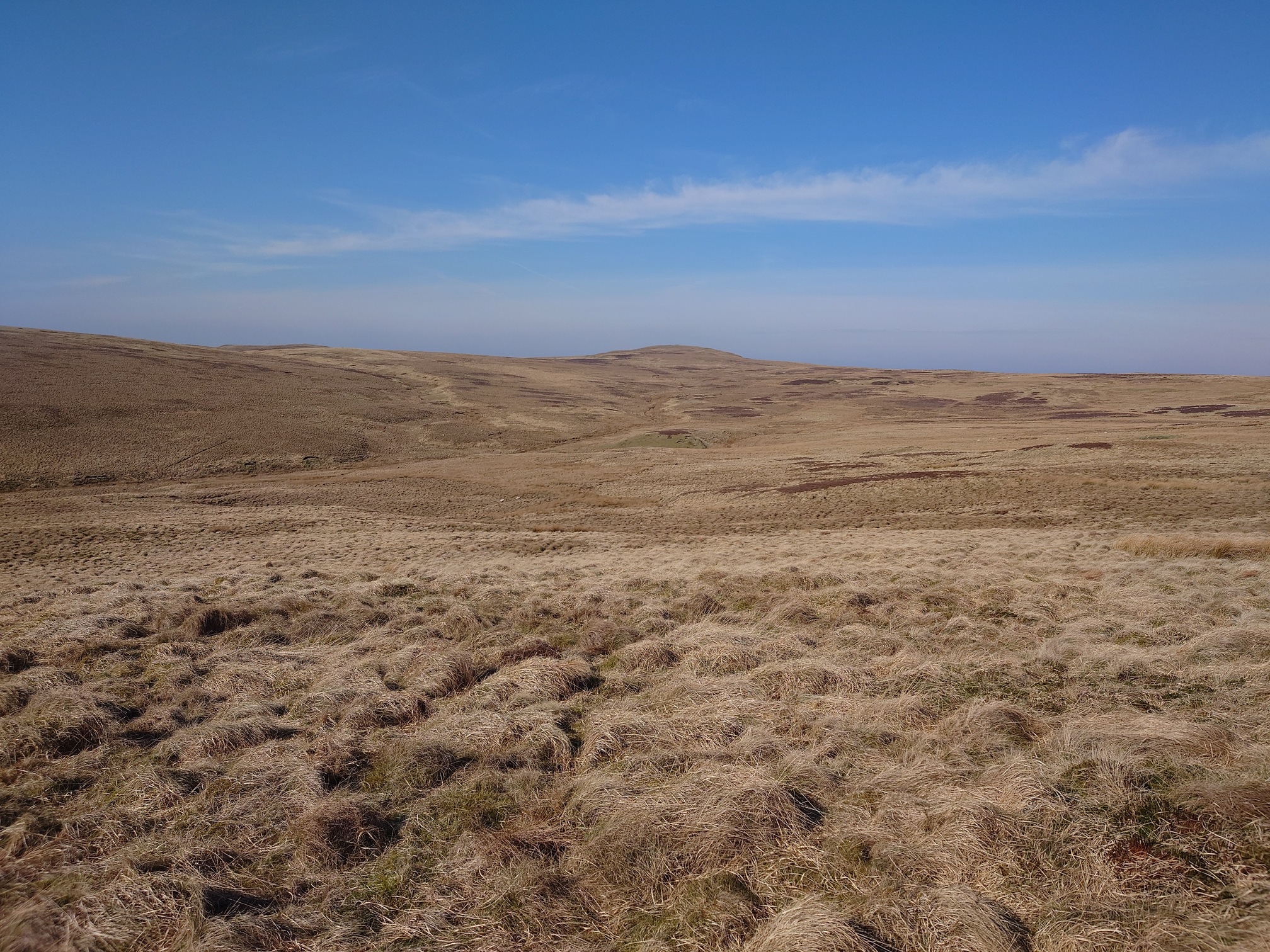
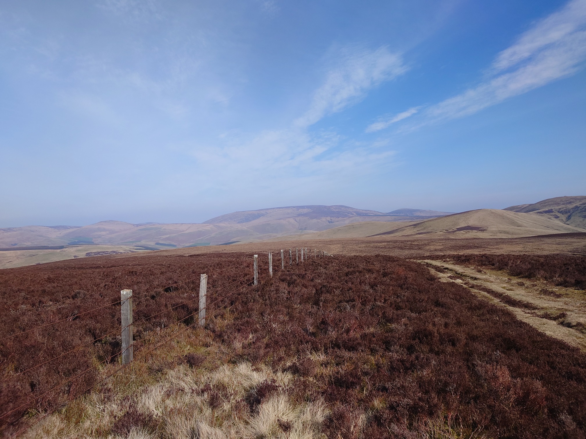
From here I crossed some rough grassland around Wedder Hill, and reached the Pennine Way running alongside the Border Fence. The landscape felt vast here; this view is looking from Wedder Hill southwest towards Gaisty Hill, just over the border.
 |
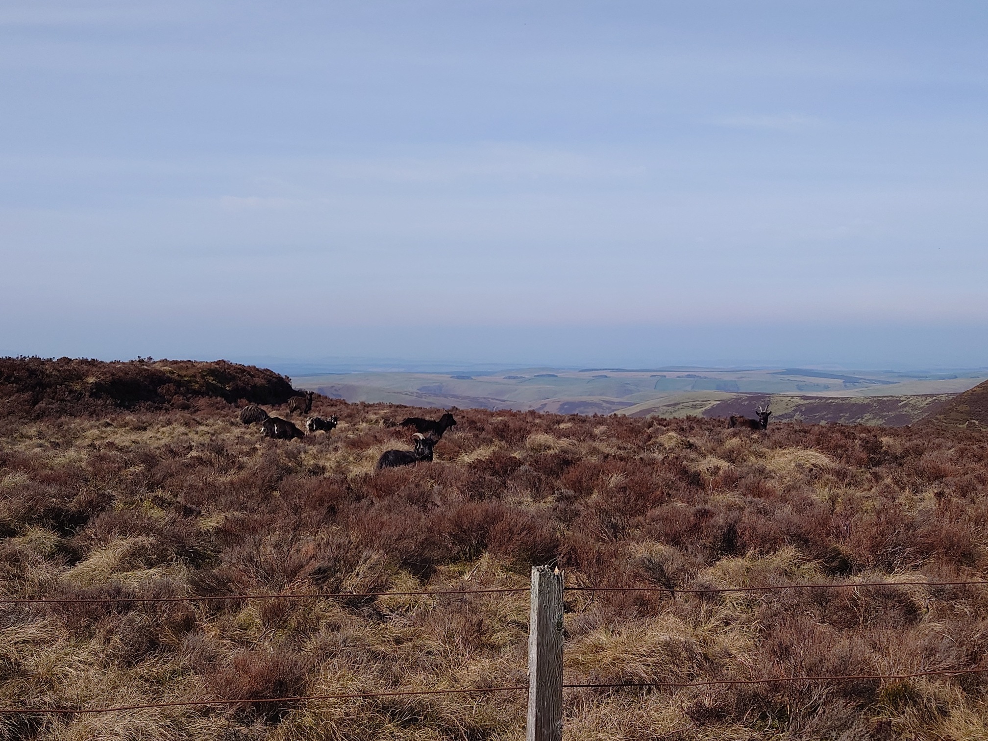
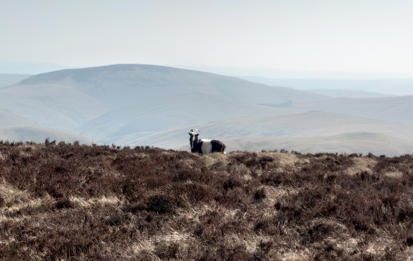
Also keeping me company as I walked along the border were the Cheviot Goats, with the entire flock spread out along the ridge. I even saw a nanny with a very small kid, which was adorable! These are a British Primitive Goat breed, being feral in these hills since at least the early 1700s and possibly much, much earlier.
 |
 |
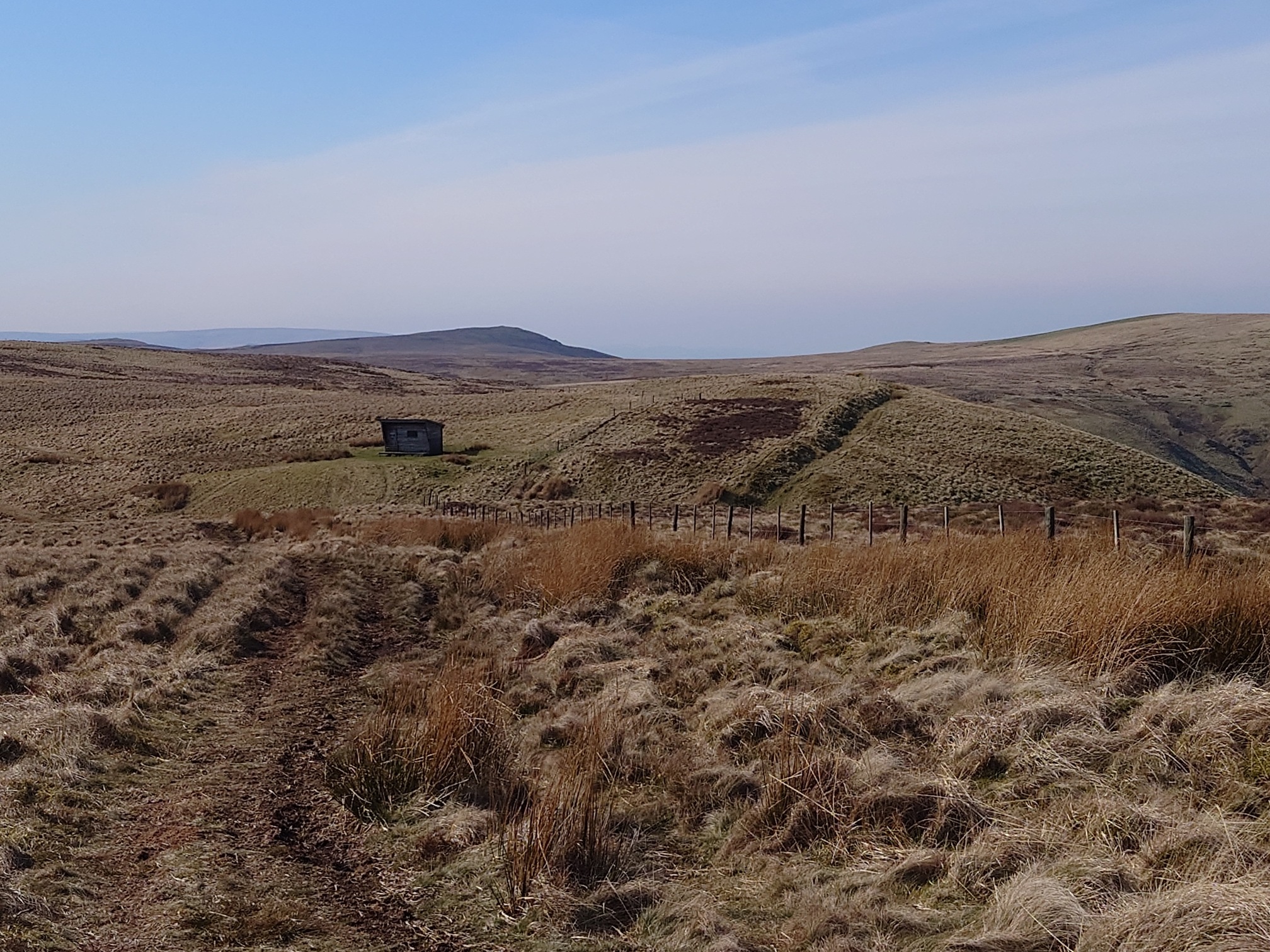
Not far from where I joined the Pennine Way, I went to have a look at the Raeshaw Fell Crossdyke, a linear earthwork that lies parrellel to the ridge and intercepts an old path that descends to the farm Pellinick, about 1km inside Scotland. The path is intersected by three more crossdykes on the way down, and it is presumed that they had something to do with defense, or control of traffic; they are found across the Cheviots and are usually associated with Iron Age hillforts. You can see it in this image, behind the Lamb Hill Mountain Rescue Hut.
 |
The rest of the walk was wonderful in the sun, and I didn’t see anyone until it was time to turn off the border and head back down into Coquetdale from Mozie Law, along The Street, an ancient cross border route and drove road that drops down to meet the river Coquet at the site of the infamous Slymefoot Inn. I turned off a little before then, and walked back along the road to the car.
 |
|---|
| The Cheviot looms in the distance |
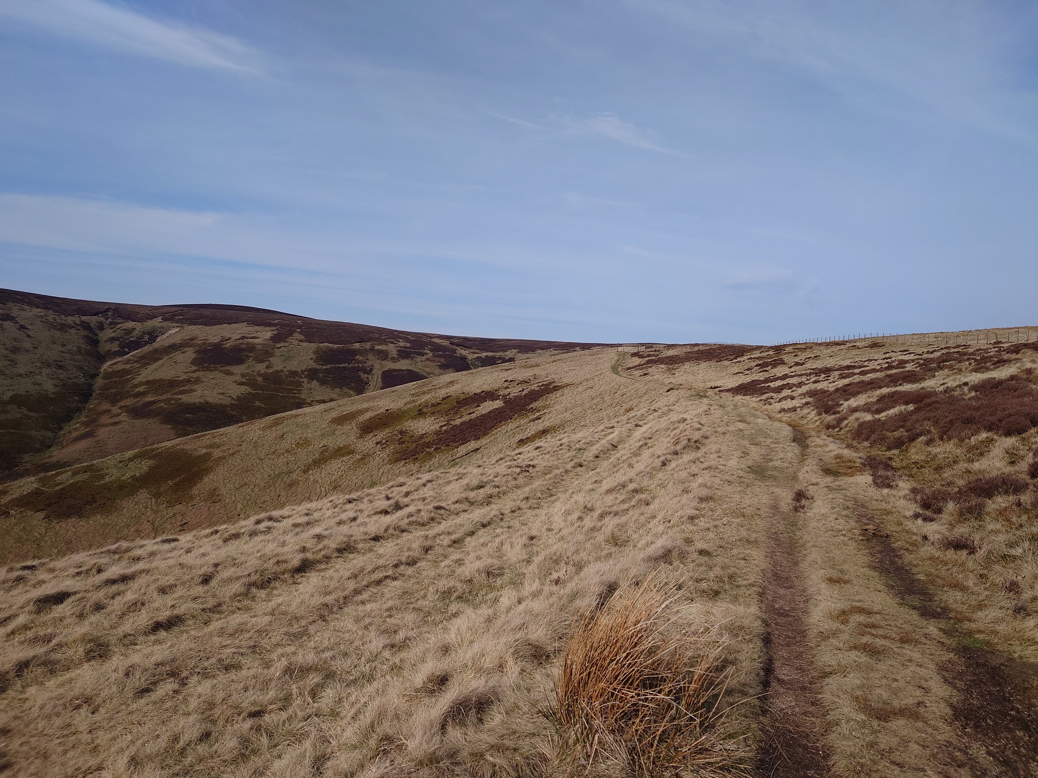 |
| The Street descending from the Border Ridge |
Very lovely today to be able to get out and enjoy the sunshine on top of the hills.
| Map of route taken |